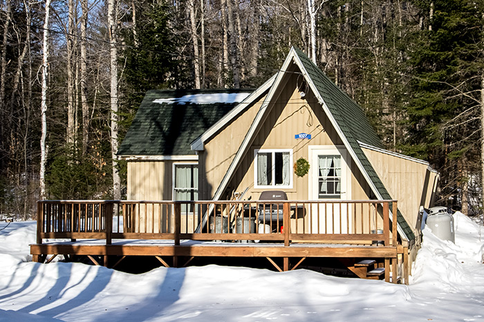
Carrabassett Valley, Maine is an incredible area. It’s beautiful and active and just plain fun to be around. In the following posts, I share our adventures in the area, whether they be hiking or driving around or riding ATVs. Please browse through all the photos I’ve taken and take a moment to read what I’ve written about the variety of different activities.
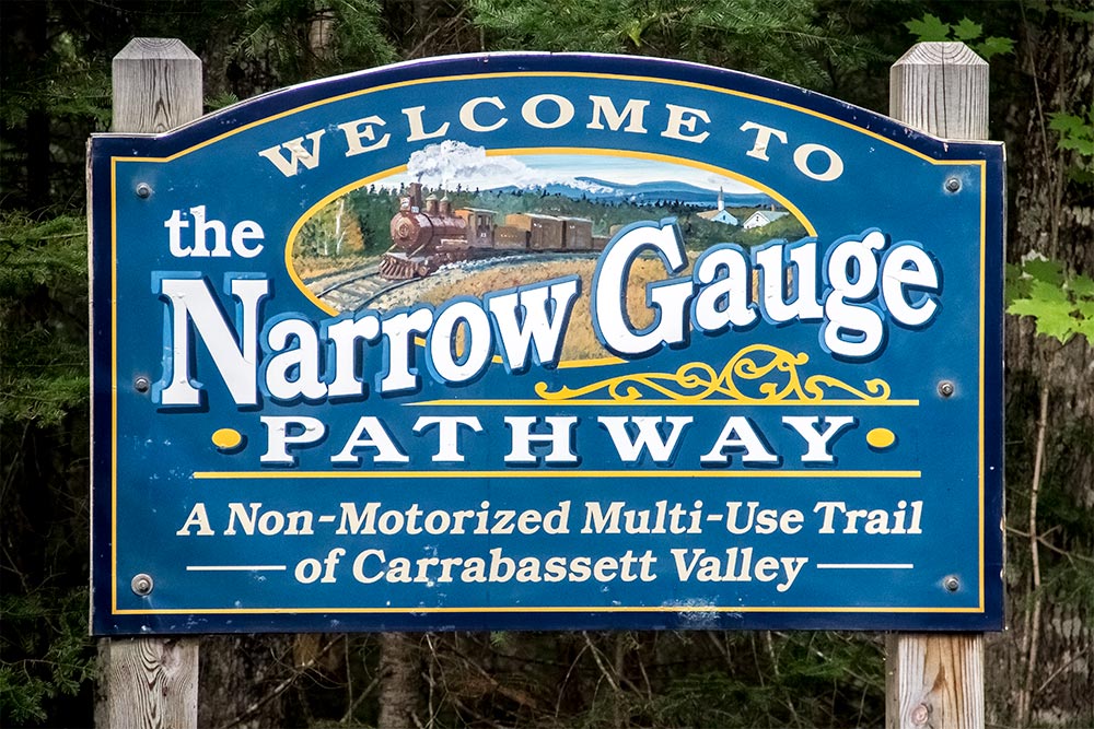
First Bike Ride on the Narrow Gauge Pathway in Carrabassett Valley
September 22, 2017
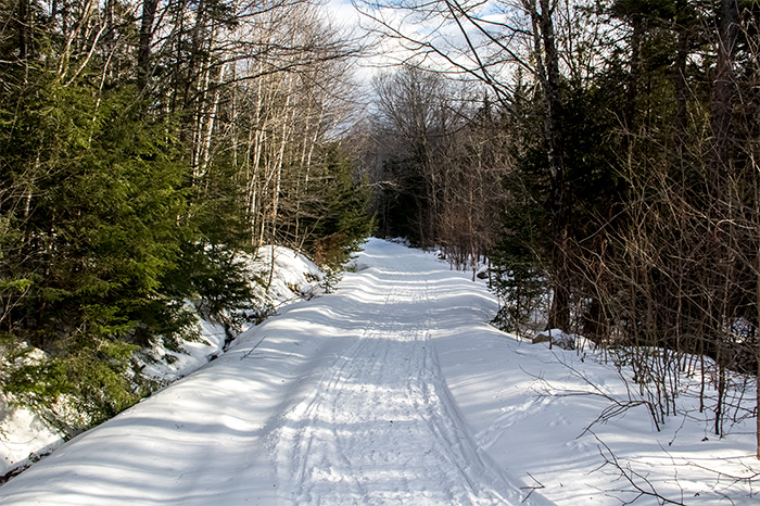
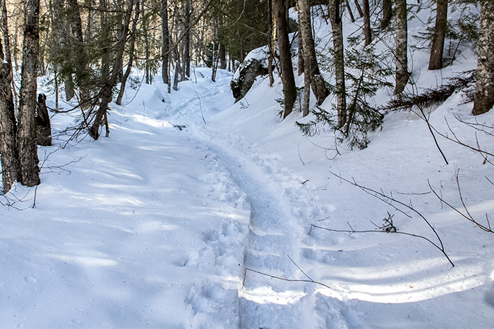
We’ve already walked on this trail a few times, but yesterday was the first time we rode our bikes on the Narrow Gauge Pathway up near Sugarloaf Mountain. I’m happy to report that our ride was just as enjoyable as our walks have been. The trail is smooth, fairly long and it even has a few offshoots for the adventurous riders among us. Those offshoots are more for mountain biking and they range in levels of complexity. Some are easygoing and straightforward while others are much more technical for the advanced rider. Since we are merely casual riders, we stuck to the beginner trails. More on that below.
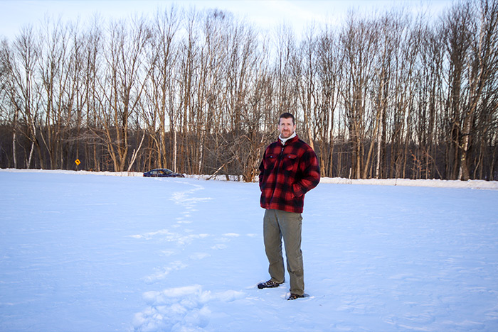
I was forced to drive the truck up to the trails yesterday. I didn’t want to do that because it gets something horrible like eight miles to the gallon as far as fuel efficiency goes. Surprisingly, I used less than a quarter tank of diesel for the whole trip. That wasn’t as bad as I thought it would be. The reason I had to drive the truck was because I haven’t been able to find any decent bike racks for the car. The ones available online are very flimsy looking and I’m not in the mood to spend a lot of money for a rack made specifically for the model of car we own. Every time I do that, less than a year goes by and I get rid of whatever vehicle it was I just “customized.” I hate it when that happens. No matter. I’ll just drive the truck when we want to ride the bikes. We don’t do these things all that often anyway.
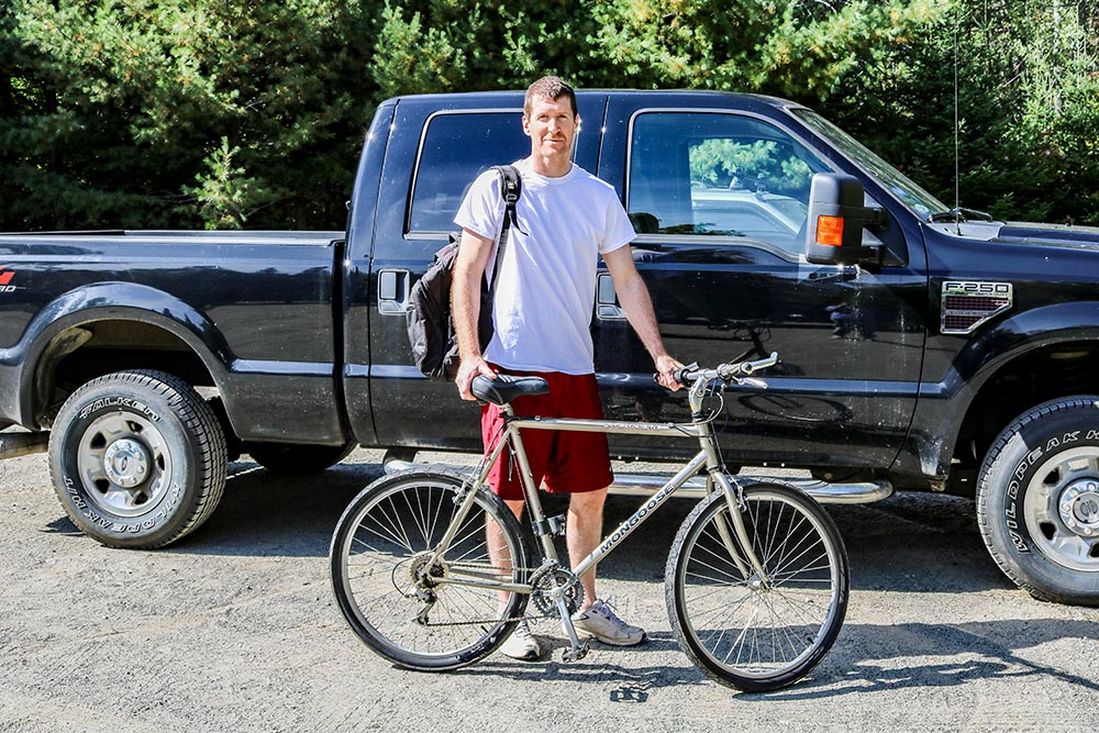
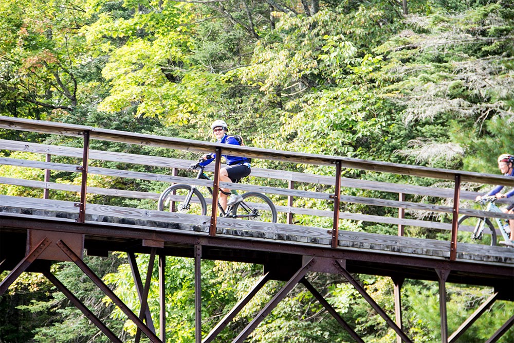
We arrived at the parking lot that sits approximately 1.3 miles east of the trail head near Sugarloaf. I know this distance because there are marker signs all over the place. After I unloaded the bikes, I had a few photos taken of me so I could remember the moment whenever I reread this post. This is the best photo by far.
By the way, since I already took so many pictures the last time we visited this area, I really didn’t take too many this time. Also, it’s sort of difficult to do that sort of thing while riding a bike.
Anyway, here’s a photo of my bike. I’ve had this thing since I was living in Binghamton, NY while going to college in 1996. I bought it when I first arrived, for something like $300 and it’s been everywhere I have since. It’s a perfectly good bicycle. So good, in fact, that I made a few upgrades to it. As you might be able to see in the photo, I added those additional handlebars that face towards the front tire. I also switched out the tiny, extremely painful little seat that comes with these types of bikes for a larger, more cushioned version. Finally, I pulled off the knobby tires and replaced them with some plump road tires. I probably ride on the road more than anything else and I never saw a need for too much tread.
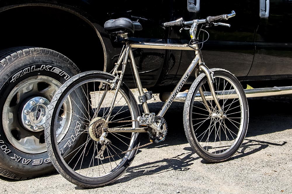
Notice how it doesn’t have any shocks or anything like that. I don’t need them because I ride old school.
The weather was perfect yesterday. It wasn’t too hot at around 73 and not too cool during midday. Later on, I had to put a sweatshirt on, but that’s why they’re made. I’m sure you agree when I say that autumn weather is the best because you can still wear shorts, but it’s just cool enough to pull a hoodie over your head. No sweat. That’s what I like the best.
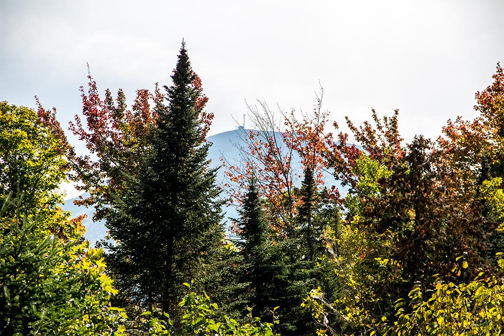
As we were riding towards Sugarloaf, I noticed a tower at the top of the mountain peeking through the trees. I decided to grab a photo of it.
As you can see, the leaves are somewhat changing. There’s still a lot of green out there, but fall is definitely here. As we were riding through the trails, we saw a lot of leaves falling from the trees. It was very nice.
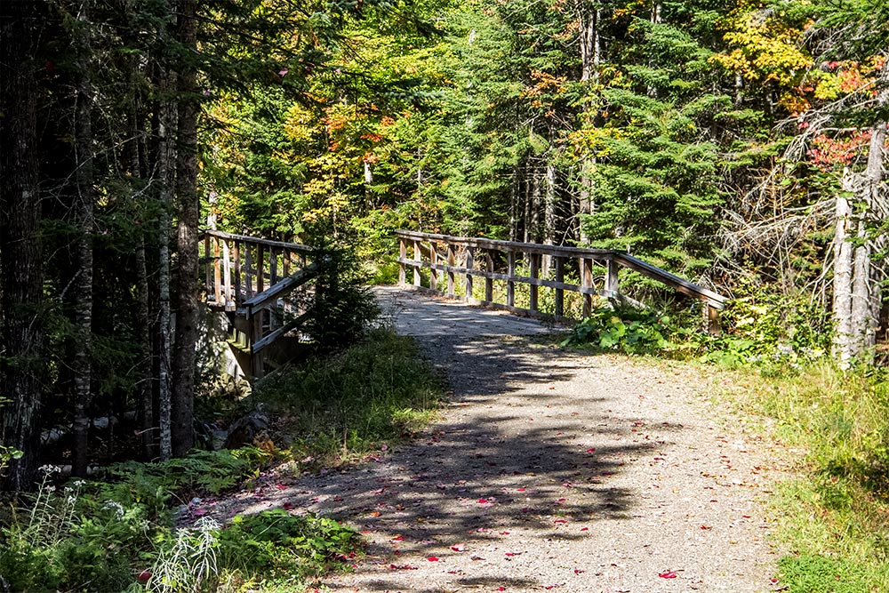
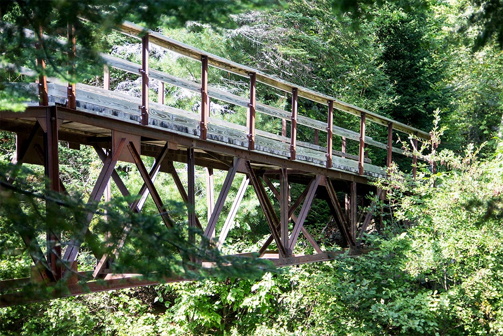
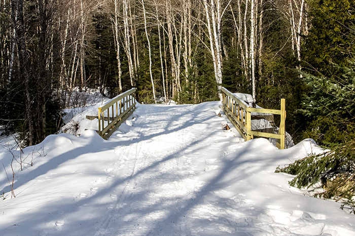
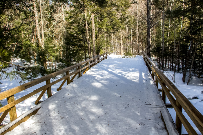
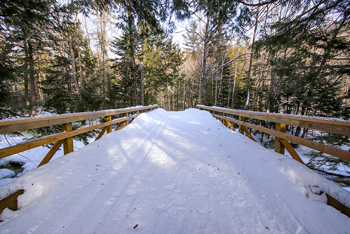
This pathway is full of wooden bridges and beautiful twists and turns. Sometimes, it’s best to take a break for some photos.
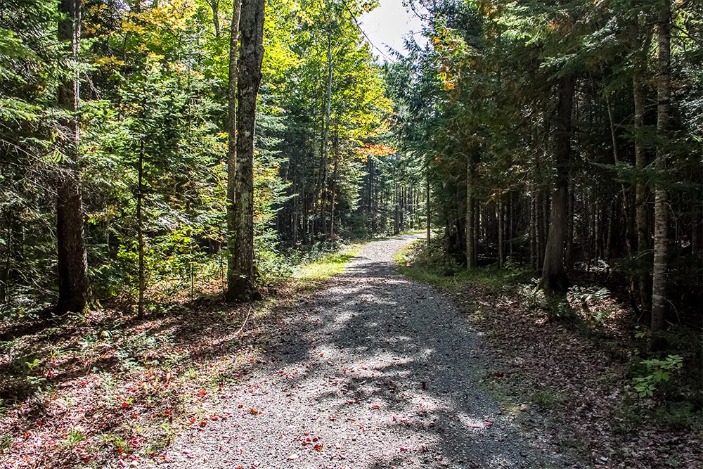
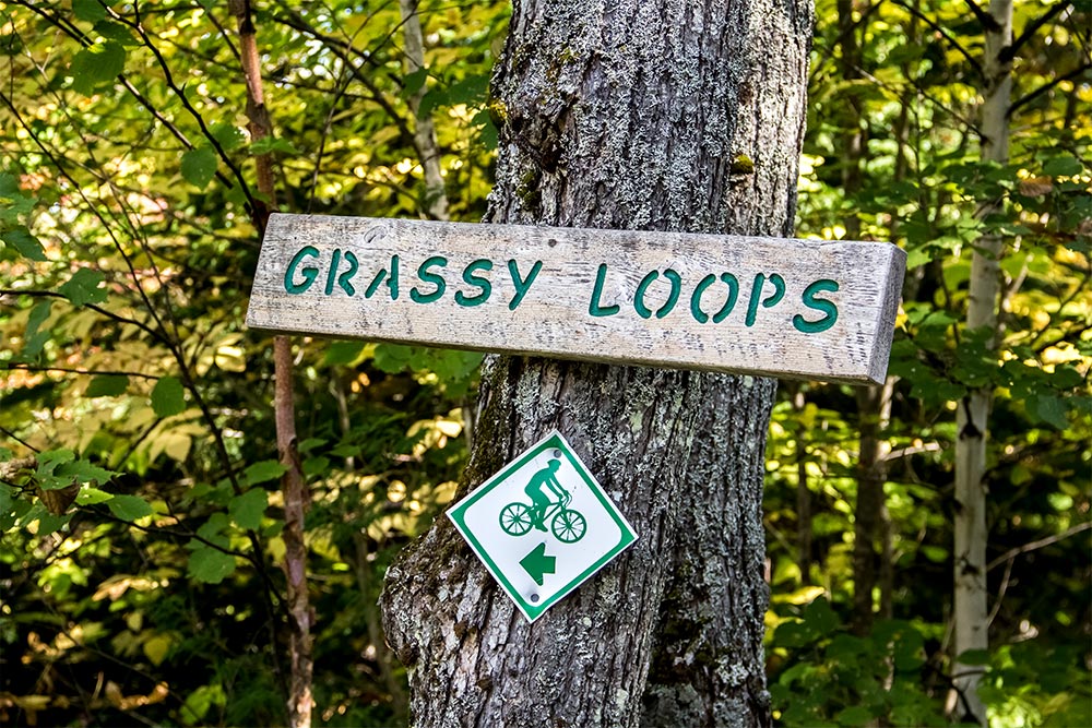
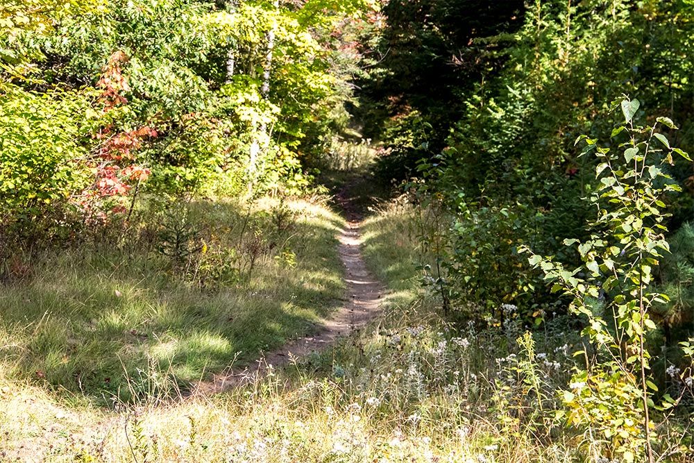
Along the primary rail trail, as I mentioned above, are offshoot trails that offer a bit of variety for riders of all skill levels. One trail called “Grassy Loops” is for beginners. The nicest thing about this particular trail is that it’s very smooth and is more open than some of the others. It’s almost as if someone mowed the grass along its entire length.
While the ride along this path was very peaceful, and I know this is awful to think of, but I kept telling myself how I could really tear this sucker up if I was riding a motocross bike. It had the perfect soft and fluffy dirt to spit out from behind while slamming through some gears. Okay, enough of that. I was merely daydreaming.
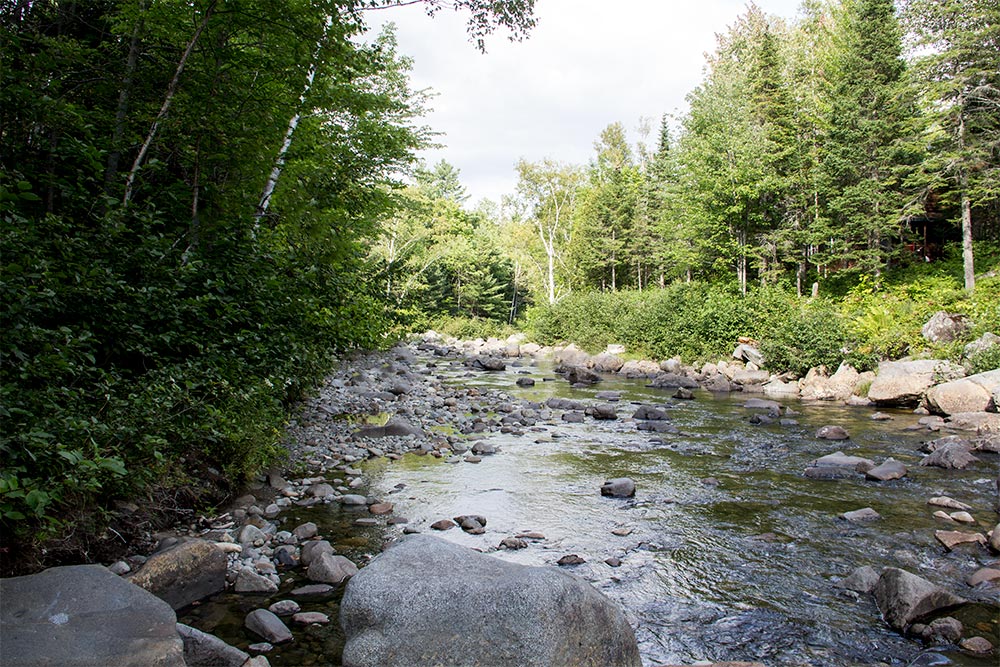
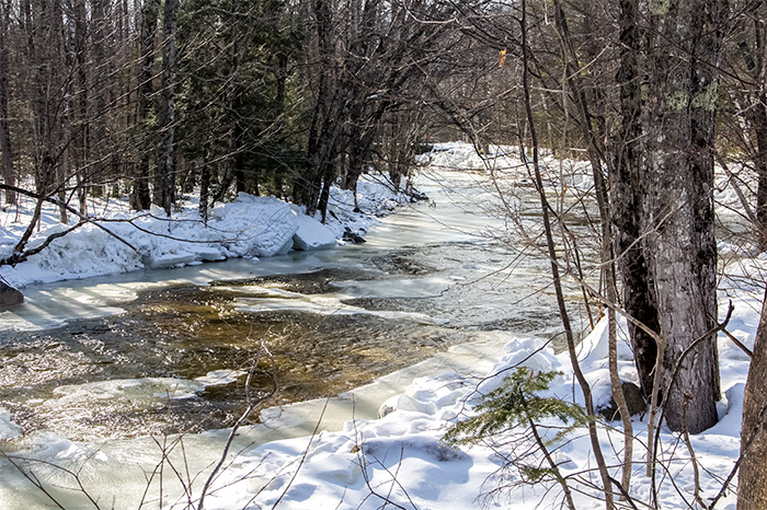
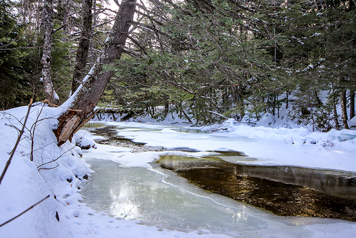
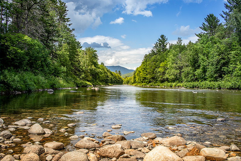
Some of the most beautiful sections of the trail are those that hug the Carrabassett River. We made it down to one such area and decided that we had traveled far enough. Since it was our turn around spot, we rested for a while and grabbed a few more photos.

The edges were rocky and steep, but I still made my way down to the water for a photo. It’s just something I need to do every time I visit this area.

Since I didn’t want to duplicate other photos I already took too much, I decided to stop taking pictures at this spot.
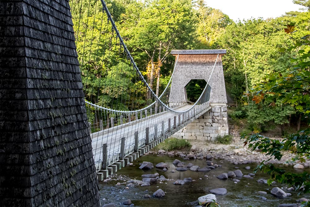
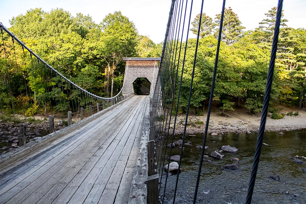
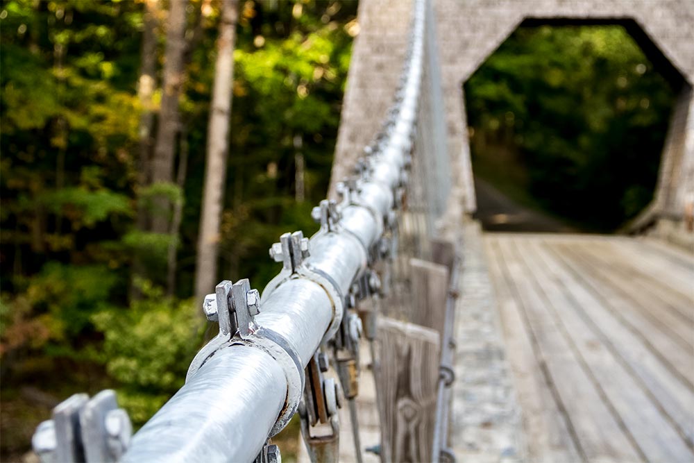
Wire Bridge in New Portland, Maine
After our ride, we stopped off at Longfellows in Kingfield for a nice lunch/dinner. After that, we made a quick visit to Wire Bridge in New Portland. This is just something that needs to be done every so often. It’s the perfect monument to photograph and it’s a pretty cool place to hang out as well. Since I don’t want to bore you with these photos because I already took so many, I’ll just post a few here.
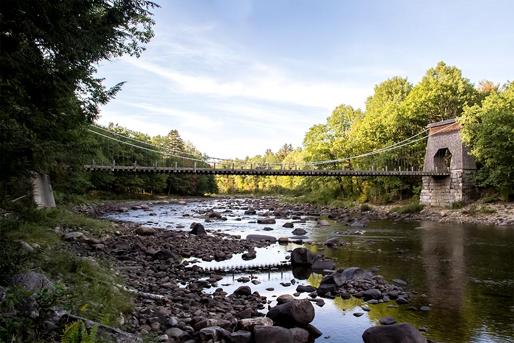
Now that I look at the old photos compared to the new ones, I can see that the new ones look a lot better. That’s most likely due to the time of day these were taken. Closer to dusk is always better for photography. I’ll show you a few more.


I have a huge surprise for you. Since it’s the end of the post, I suppose I should share a few photos from the end of our day. As we were driving home, we passed by a field with a fairly good number of red deer in it. When I noticed this, I quickly pulled over and we both began taking mad pictures. Here are two of the best that I was able to get. Check out this big boy. The first is a huge male walking away from me.
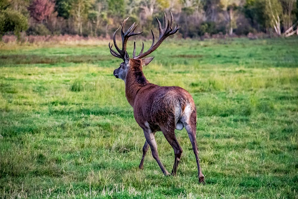
And this next one is the money shot. I got him looking right at me.

I hope you enjoyed this post. If you have any comments, please leave them down below. I always reply. Thanks for reading!
Walking On the Narrow Gauge Pathway Near Sugarloaf Mountain in Maine
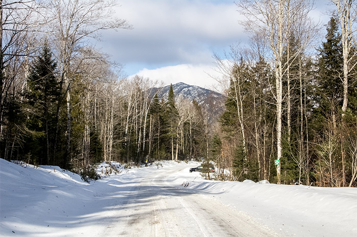
Something fun needed to happen today. It’s been a while since I’ve been up and at ’em, so I was ready to get out there and make it happen. Last night’s temperatures dropped into the 40s and today’s didn’t make it out of the 60s. The sky was clear and I thought it was high time to get back up to the rail trail near Sugarloaf Mountain. We haven’t been to that area in quite a while and after looking at the local map this morning, I thought it would be a good idea do get packed and do some walking. Recently, we’ve been sticking to our nearby roads for exercise. If you’re a walker, you probably know how boring that can get. I’m always trying to find new places to go and new things to see. Especially when it comes to walking.
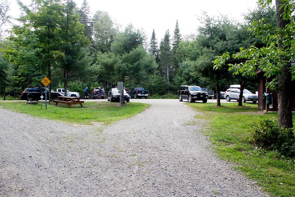
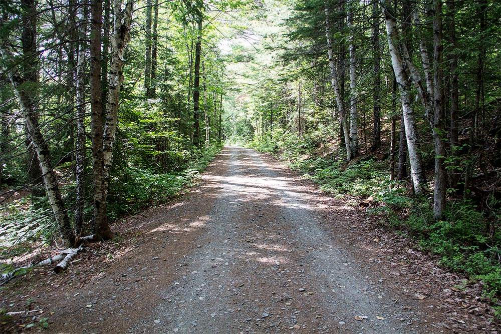
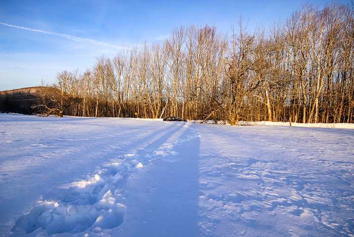
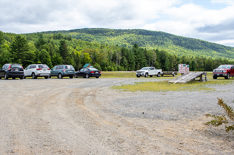
If you remember our last visit to the area, you’ll remember that we started our walk directly north of the small airport in Carrabassett Valley. That’s a really good place to park and leave from because there’s tons of room. Since we already did a bunch of walking around there last time, I figured we could head north about three miles and park at another dirt lot to see what that was like. Good thing we did, because this new spot was much better than the previous one. The trees are more mature and it’s greener all around. And the parking lot is very casual. I took a bunch of photos for you.
If that parking lot picture didn’t excite you, perhaps one of the sign that described the rules will.

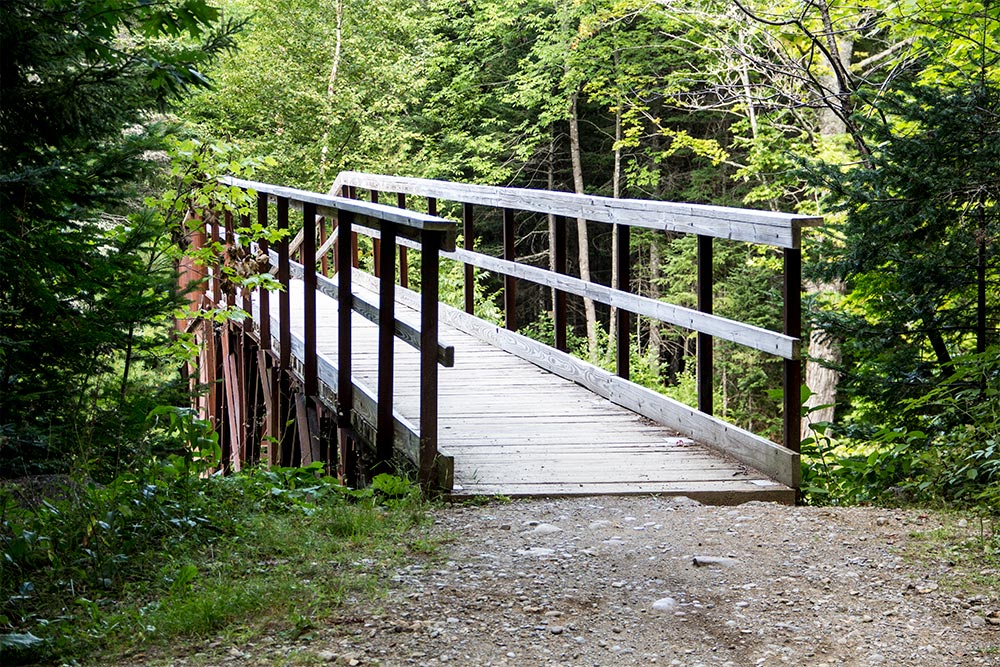
The parking lot is on the opposite side of the Carrabassett River than the trail is on. Luckily, there was a really cool steel bridge built for us to use to get to the other side.
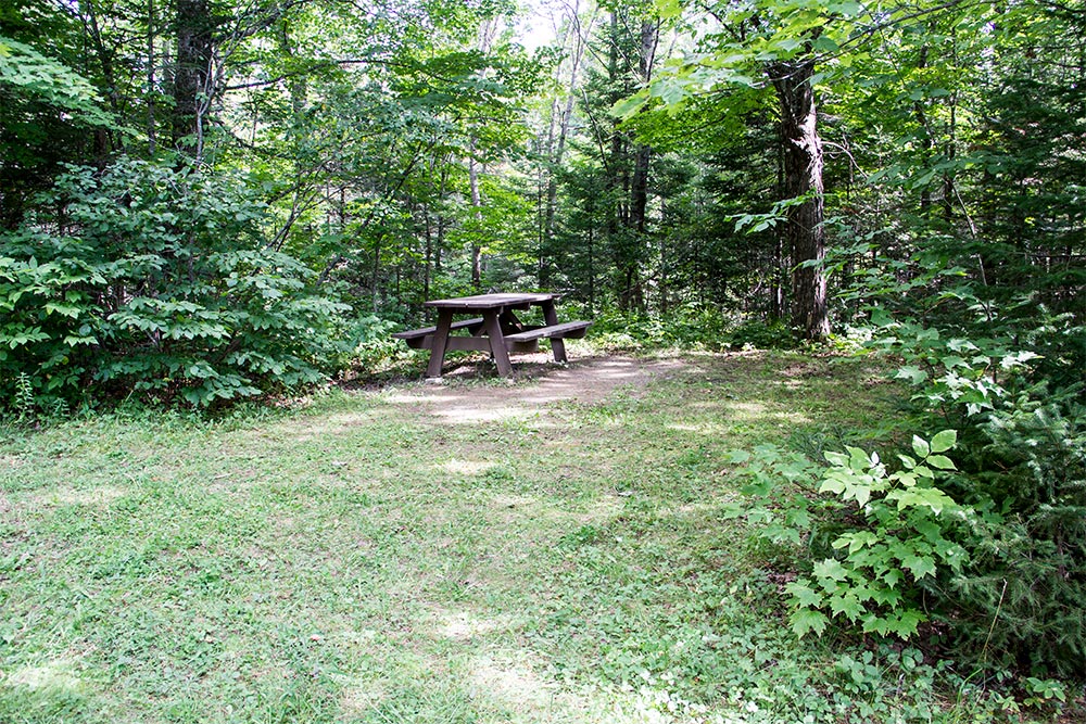
Before crossing the bridge, we followed a short path that led to a picnic table. Near the table was another path that led down to the river. While I was down there taking some random pictures, a few bicyclers crossed the bridge. One of them was kind enough to smile for me. Everyone was very friendly.
While I was down there, I grabbed a few more shots of the bridge. I found it interesting.

The best part about this particular trail is that it’s fairly narrow. I’ve been on a few different trails of this type and many of them were created from more traditionally sized train tracks. Since this was a narrow gauge, the trail is much more cozy. A full size truck can still fit on it, but not nearly as well as on one of the wider versions.
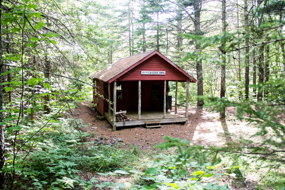
I don’t know what this is, but it was directly off the path. I’m guessing it’s some sort of train related building from years ago. The sign on it says it’s from 1900.
I wasn’t expecting this, but there really are some beautiful wetlands that surround parts of the trail. I took a few photos of them. Okay, I took a lot of photos, but narrowed them down to just a few.
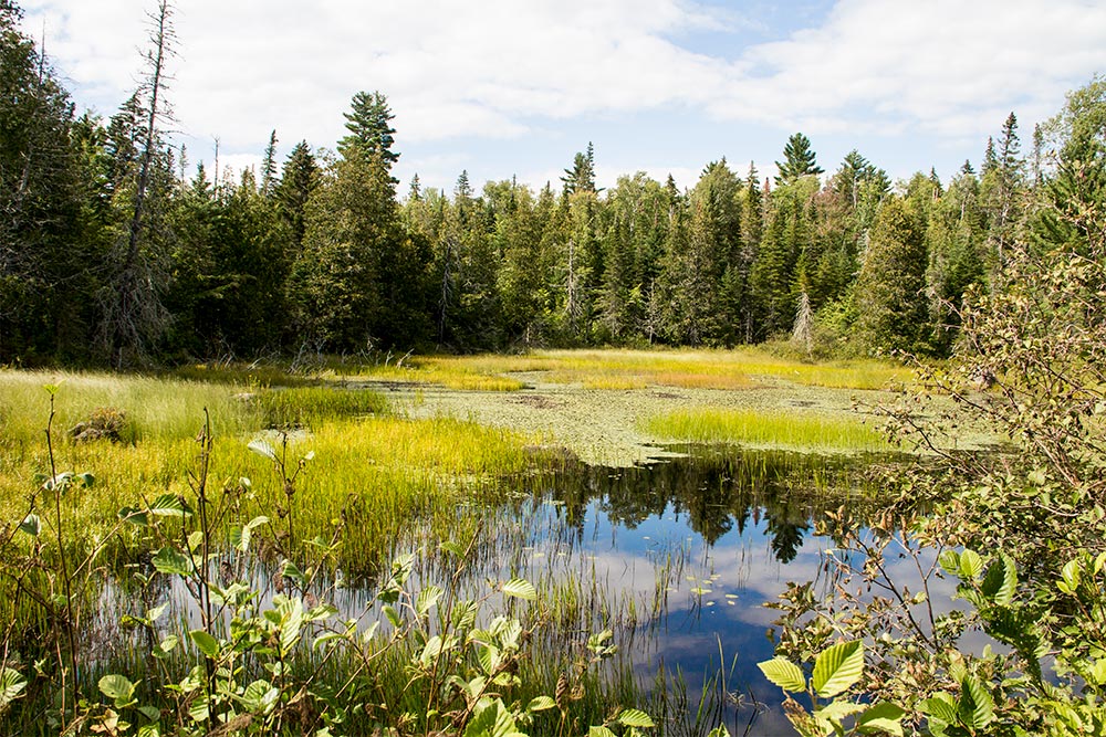
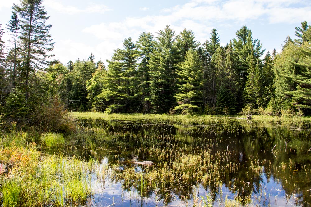
While we were there, I saw three ducks and one fish jump out of the water. It was a large fish because it made a substantial splash. I’m guess three to four feet long. Okay, kidding, but it was big.
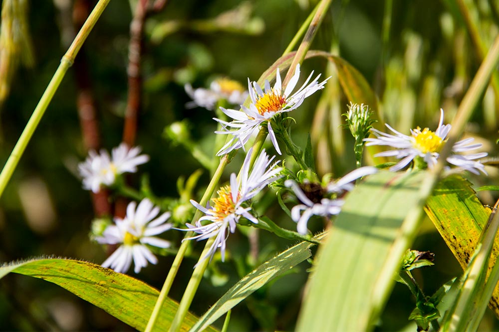
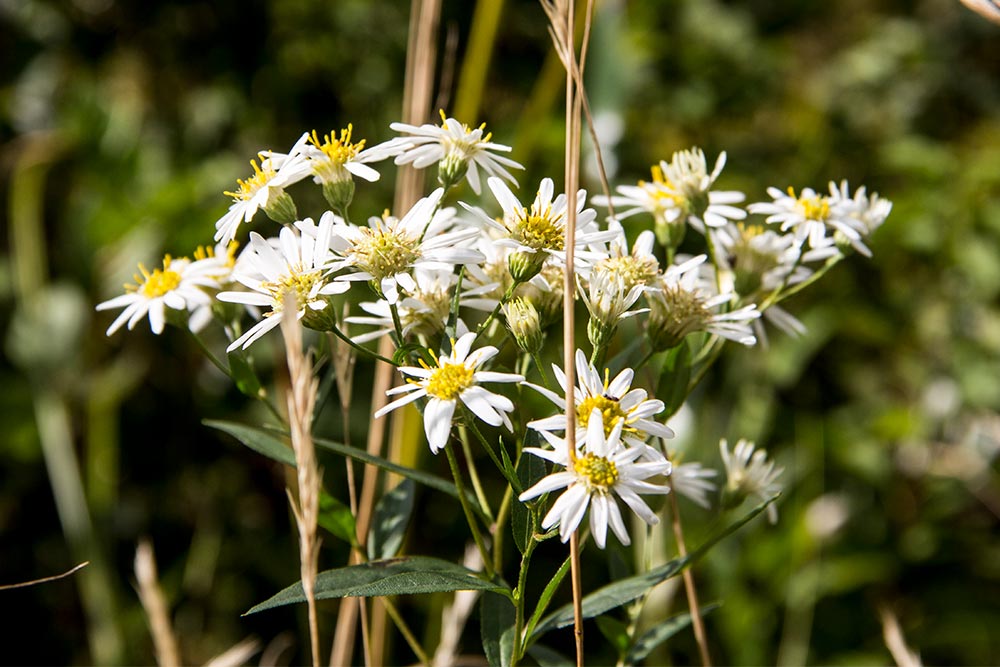
I even managed to take photos of some purple aster and another similar looking white flower.
This is the bridge that lead us through this section of wetlands. I was surprised at how many people were on the trail today. It wasn’t like this the last time we were in the area. Virtually everyone was on bicycles too, so we’ll have to fill the tires with air in ours and get riding.

Along the pathway were a few areas with picnic tables in them. I might just take advantage of this amenity next time and pack lunch. I don’t ordinarily do this sort of thing, but I’m getting older and more relaxed, so parking and eating for a few minutes won’t be so bad. I’m sure of it. Especially during this time of the year when there are hardly any bugs left.
The really cool part of the whole thing is that there are tons of mountain bike trails on both sides of the pathway. They are much more narrow and wind their ways through the woods. As a matter of fact, on our way back, after we turned around on the main trail, we walked in one of the bike trails. That’s pretty fun and leads down towards the Carrabassett River.
I don’t know if you can see the dirt trail here, but it’s shaped like an “S.” Each of these trails is named as well and the name is engraved into a piece of wood that’s hung from a nearby tree.
If you’re into mountain biking, you’d be in heaven around here.
Finally, we made it down to the river again and took a bunch of pictures. They became repetitive as I was looking through them, so I just closed my eyes and selected two to show here.
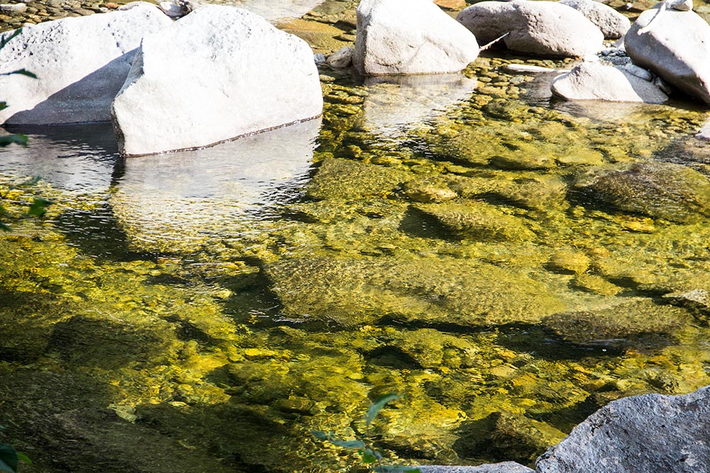
Since it’s the end of the season, the water was low. It sure was clear though.
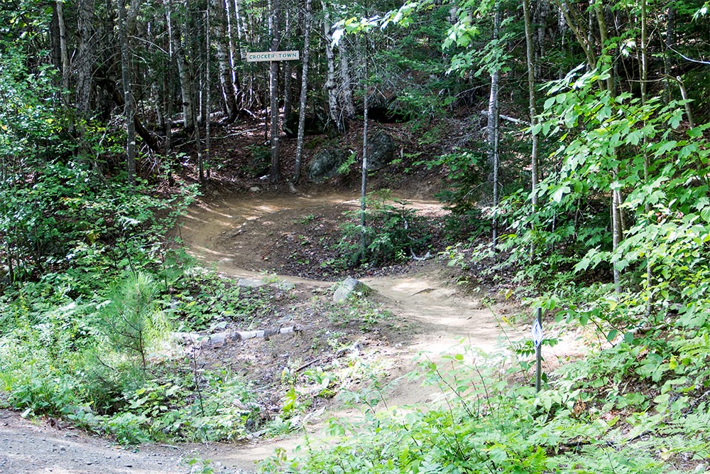
As we made it back to the parking lot, I saw the perfect sign for the end of this post. Take a look.
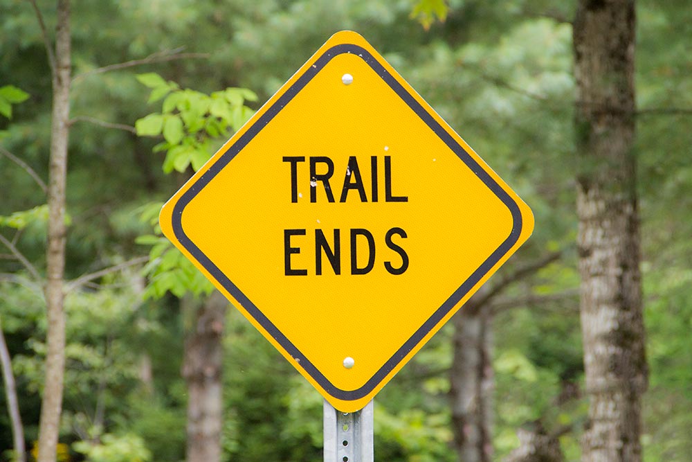
The trail ends. If I had to guess, I’d say we walked about three miles today. Not bad. Next time, we’re going to take the bikes and cover the entire eight. That’s easy on bikes. Thanks for reading!
Hiking to the Maine Huts & Trails Poplar Hut in Carrabassett, Maine
January 20, 2018
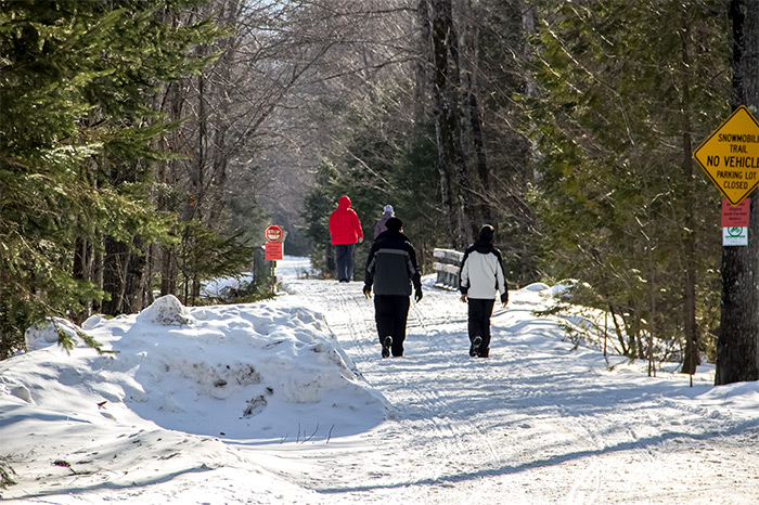
What a perfect day. We just got back from exploring the wilderness and I have to tell you that this winter hiking really is a thing. There were people all over the place in the woods. I was so surprised. I even snapped some photos of them to prove it.
I used to think that only people on Youtube actually hiked around out there in the snow. That really isn’t the case. From what I saw today, half the state of Maine was either skiing and snowboarding at Sugarloaf Mountain, snowmobiling through the thousands of miles of trails we have here, snowshoeing up in Carrabassett or cross-country skiing in the same area. It was crazy. I was actually very pleased with all of it because seeing everyone out and about inspired me to get out there more. There really is no excuse. Lord knows there’s enough gear to keep me warm and trust me when I say that there’s no shortage of opportunity. Within minutes, I can be on brand new cross-country skis and up in a trail trying them out. It’s nuts, really.
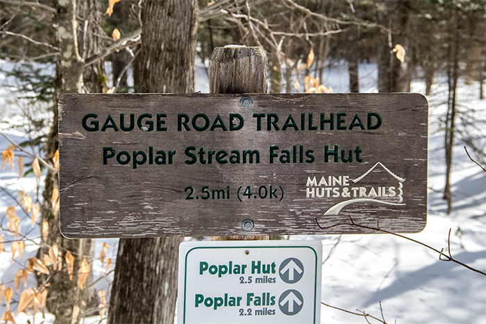
I have a fun story to tell you about today. Earlier in the week, I made a plan to get out there and do some hiking in an area I found online. Laura and I have been nearby this area before, but never in the snow, nor the winter for that matter. The problem was, since I have never actually seen any of the trails I wanted to visit in person, I had no idea what the topography was like. Also, after looking on a web page that described the area last night, I learned that the dirt road I had planned on driving up was closed for the season. That was fine. I told Laura that we would just hike up the trail that traveled the length of the road, right next to Poplar Stream. Sure, it was two and a half miles each way, but we’d make it. No problem.
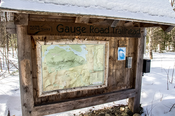
The goal for today was to visit Poplar Stream Falls. This is a waterfall that sits up inside a nook on a mountainside about three miles from the closest paved road. To get up there, you either have to drive when the weather is good or hike when the weather is bad and the road isn’t passable. If we were feeling extra good, we could continue past the falls and visit Poplar Hut, which was built and is operated by Maine Huts & Trails. I’ll write a post that describes this organization at a later date, but let me just tell you that they really do have something spectacular going on up here in Maine. I’ve never even heard of something like what they have and it’s inspiring, to say the least.
During today’s hike, I took tons of photos. As I usually do, I’ll share the photos below and offer some commentary to go along with them.
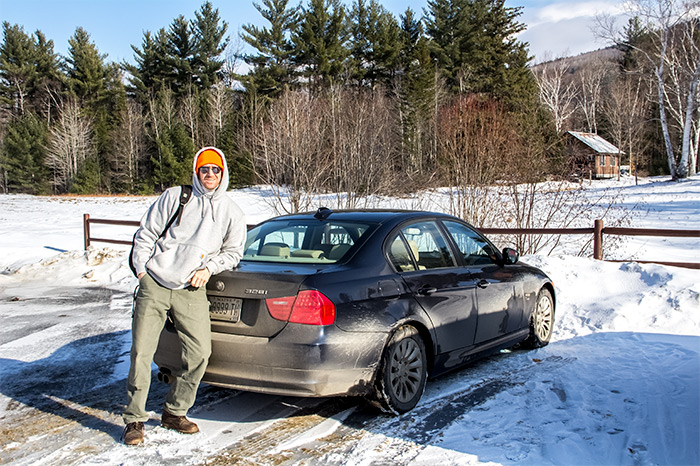
When we first arrived, we decided to park at the Carrabassett town offices. They have a parking lot that anyone can use when they’re hiking. The Maine Huts & Trails Poplar Stream parking lot was closed. So basically, we had to park all the way at the bottom and walk up the road to see how far we could get. After that, we’d cross a small bridge and enter the trail.
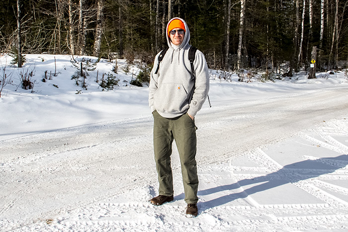
Here’s the first photo. We just parked and I asked Laura to grab one of me. I was feeling very handsome.
The Carrabassett River is right near the parking lot and there was an extraordinary amount of huge ice chunks all over the place. I tried to get some decent photos of them. Here’s one.
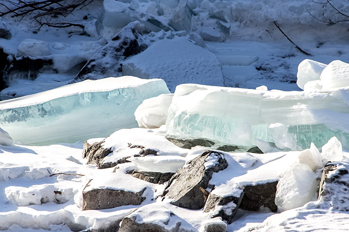
Look at how clear that ice is.
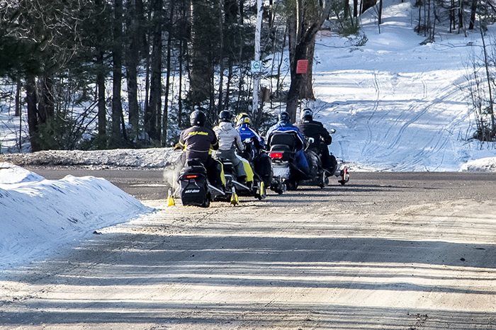
As soon as we made it out onto the road, five snowmobiles passed right by us. I grabbed a photo of them when I thought about it because I’m still in awe that these things are allowed to drive around anywhere like this. In this photo below, they are heading down Carriage Road and are ready to cross Rt. 27 to head into some other trails.
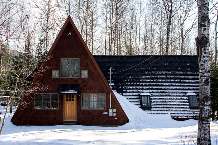
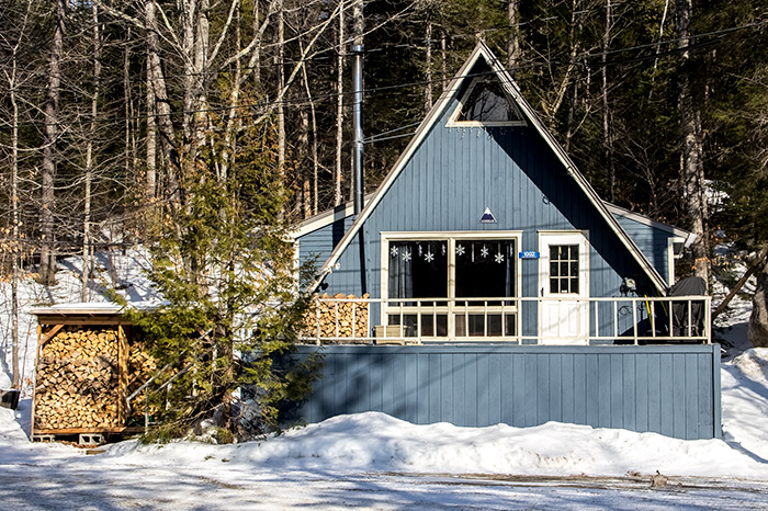
You know you’re in snow country when you start seeing a-frame houses. On Carriage Road, this type of home is quite popular. I took some photos of the different styles of houses here, just in case you’re interested in that. Check out these photos.
Here are two photos of the road itself. I took these after we walked about a quarter mile. The first is Carriage Road facing south, towards the parking lot from which we came and the second is Carriage Road north, where we’re headed.
This is a photo of one of the entrances to the Narrow Gauge Railway Trail that we’ve hiked in the past. I’ve written about this trail many times. There’s a parking lot in there, but this is the one that was closed. People still walk down there to access the bottom of the trail though, so that’s why I suspect the area was so popular.
This is Poplar Stream itself. This stream goes all the way up the mountain to who knows where. It’s pretty long. It feeds right into the Carrabassett River.
Okay, so here’s where things get interesting. As we were walking, I noticed an open gate at the bottom of the more rugged part of Carriage Road. Since I read online that the road was closed, I was expecting the gate to be closed as well. Apparently, it was not. And to make matters worse, as we were standing there looking at the gate, I waved to two SUVs as they passed us by and headed up into the mountains. I started walking back to the car and as I walked, I explained to Laura that we were about to take a risk. I had no idea what was up that road, but I did know that the car has all-wheel drive and we were going to go for it. If the SUVs can do it, we can do it. The very worst thing that could happen was that we’d somehow drive off the road and plummet to the bottom of the ravine. The second worst thing that could happen was that we’d get stuck and have to do a lot of walking. The third worst thing that could happen is that we could have to turn around and come back, only to repeat the walk that we just did, which would be really annoying. But, if things turned out in a more positive manner, I said that we would reach heights of glory we’ve yet to experience here on earth. That’s what I was hoping for anyway.
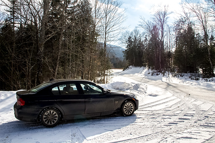
So, with all this in mind, we walked all the way back to the car, started it and drove up the mountain. The road was plowed, but it had a snow-packed base. I actually hopped out of the car half way up, just to get a photo.

This car is actually a lot of fun to drive in the snow.
The spot where I took the photo is obviously flat. There were a lot of ups and downs though. I’ll tell you this – there was one area where I almost lost my cool. We were climbing the mountain and the road narrowed quite a bit. To the right was a deep ravine with Poplar Stream at the bottom. I didn’t really know how slippery the snow was, but we didn’t have any issue. What I did know was that I wanted the parking area I had seen on satellite view to appear very soon. I had no idea how twisty and turny this road was. Plus, there’s no cell coverage up here and if we got stuck, there would be no one to call. We were on our own. It was exhilarating. I mean, really, when do you get the chance to do something like this?
Apparently, the parking area/trail that I was expecting to find wasn’t as easily identifiable as I thought it would be. We passed right by it. By the time we turned around, we were a good five miles into the mountains. I knew we had gone too far when I saw a large pond that wasn’t supposed to be there. We were actually very close to Flagstaff Lake as well, which wasn’t supposed to be there either. We eventually turned around and decided to hike into the area that looked closest to what we were looking for. There was even another car parked there.
In the above photo, you can see the car I just mentioned to the right and in the back is Little Bigelow Mountain.
After we parked, I was so excited to be out of the car that I just had to have a photo taken of me. I really should be a model for some sort of clothing line with these types of poses.
Now before you think I wasn’t wearing enough clothing, I’ll tell you that I had a t-shirt on, a thermal, a wool sweater and that hoodie. I was pretty warm. I also had my trusted Dr. Martens on my feet, so I was in good hands. I’ll also tell you that I ordered some winter hiking boots just a few hours ago. With this type of thing right in our back yard, we’ll be going back a lot. I’m getting serious about the whole idea.
Anyway, here’s where we parked the car for the afternoon. I’d say the time was about 11am by this point.
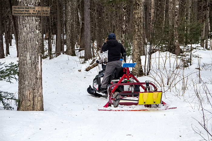
Just a few dozen yards into the trail, we found an abandoned snowmobile. If I had to guess, I’d say this belongs to the Maine Huts & Trails people. It’s strange for it to be just sitting by itself there though.

You can also see the tow sleds next to it to get supplies to the huts (I’m assuming).
This is the trail that leads to the waterfall. The hike to the falls is about a quarter mile.
After walking through the snow for a while, we came across a bridge. This assured me that we were in the correct place. There were only a few bridges up in this area and I knew exactly where we were. I had no idea where we were going, but I knew where we were.
What I really wanted to see was the waterfall in action. I knew it was close by, but I didn’t hear anything. Apparently, according to this sign, I was standing right on top of it.
The falls were frozen solid and getting down to the area where they were visible was a bit treacherous. We did make it down there somewhat, but not enough to get a great view. The snow was pretty deep and the terrain was steep. We’ll have to wait until spring to get down there for some photography.
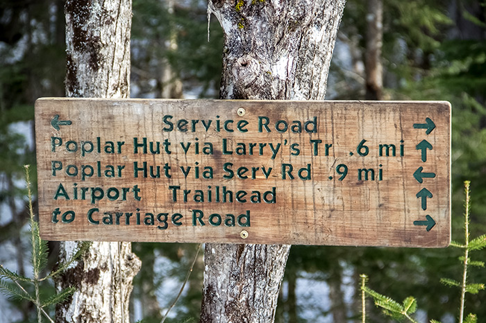
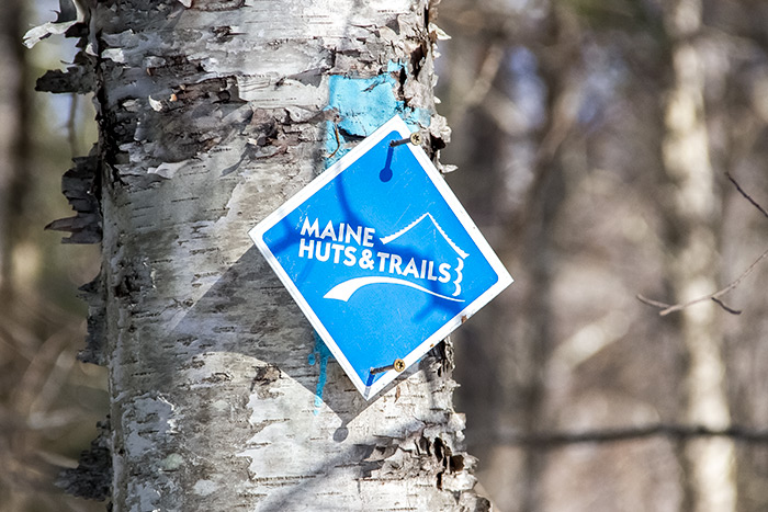
As we were walking around, we began noticing signs all over the place. Because of this, I knew we in the proximity of the Poplar Hut.

We began hiking into one of the trails. I really didn’t have any intention of visiting the hut, but since we had already gone about half a mile and stumbled across this sign, I said, “Let’s go.”
All said and done, the hike to the hut would be just over a mile into the woods. There are no roads that go there. The hut is completely off-grid and in the middle of nowhere. You really need to learn about this operation. As I said, it’s remarkable.
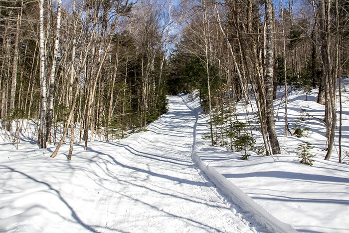
This particular part of the trails weren’t groomed at all. They traversed through a beautiful hemlock forest and were quite narrow. What we walked through was just packed snow from others before us. We walked through over a half mile of this.

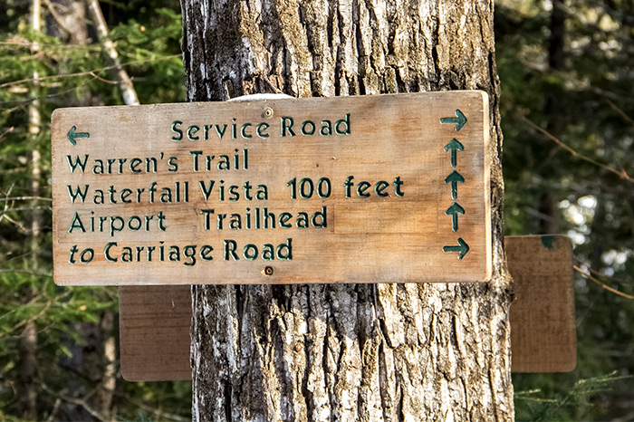
After a while, we made it to the next sign. I read it and knew we were onto something. The trail we intersected with was wider and well groomed.
If memory serves, there was less than a half mile to the hut to go, so we kept on walking. It was very pleasurable to do so too. The weather was cooperating (minus a few flurries) and it was about 40 degrees out.
Finally, we heard kids laughing and we saw them sliding down a big hill on a sled. They were really having the times of their lives. Such a great experience for kids. We walked a bit farther and saw Poplar Hut through the trees. There were a few people bustling around outside of it.
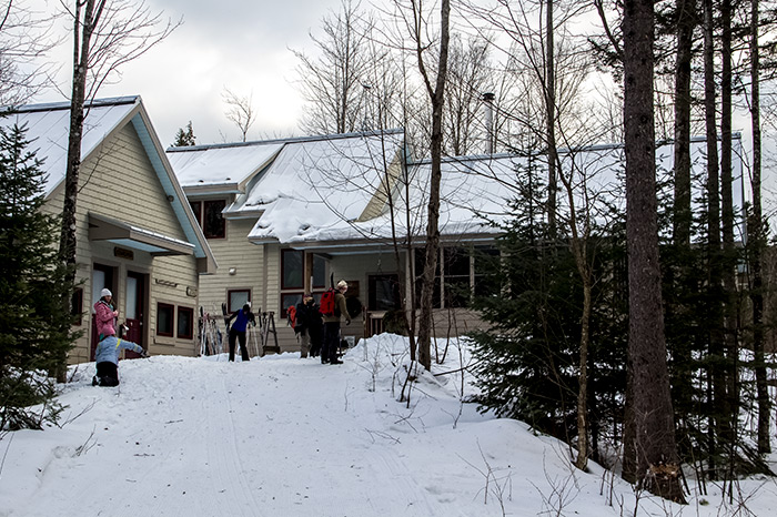
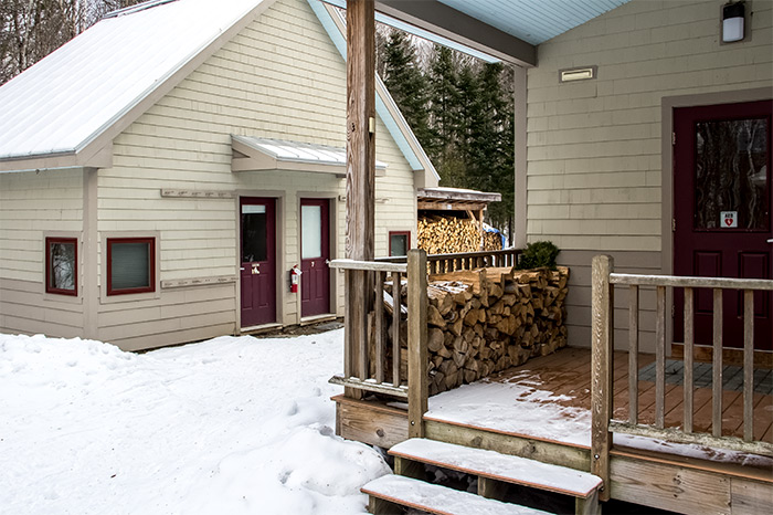
Since we were up there, I thought I should take some photos to show you how things looked. There were a few buildings and inside of the main one, you can eat lunch and warm up. We didn’t do that because we were all about business. Here are some photos of the complex.
If you wanted to, you could rent a room up here to stay overnight. That’s what the hut system is all about. Today, we saw so many people snowshoeing, cross-country skiing and just hiking around. We also saw the guy who grooms the trails on his snowmobile. He was having a good time.
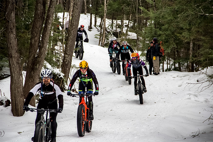
We hung around exploring the hut for a while and then decided to leave. On our way out, we heard some sort of a commotion towards the bottom of the first hill. When I looked up, I saw a bunch of guys on mountain bikes. Those bikes with the really fat tires. I had no idea you could ride those things in the snow.

Check them out as they’re riding down the trail.
The trails were so packed that people really didn’t need their snowshoes. Many simply took them off.

There were those who insisted on keeping them on though. Also, we saw hikers of all ages. It was nice. It’s really great exercise to be out there in the woods like this.

Overall, everyone was very friendly and we had a lot of nice conversations.
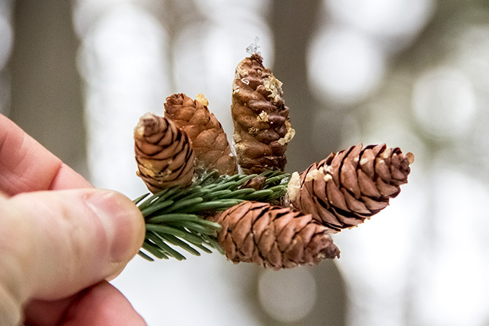
I don’t know why I did this, but I saw a nice cluster of hemlock pine cones, so I picked them up and snapped a photo of them . I thought it was a pretty nice picture, so I’m sharing it with you.
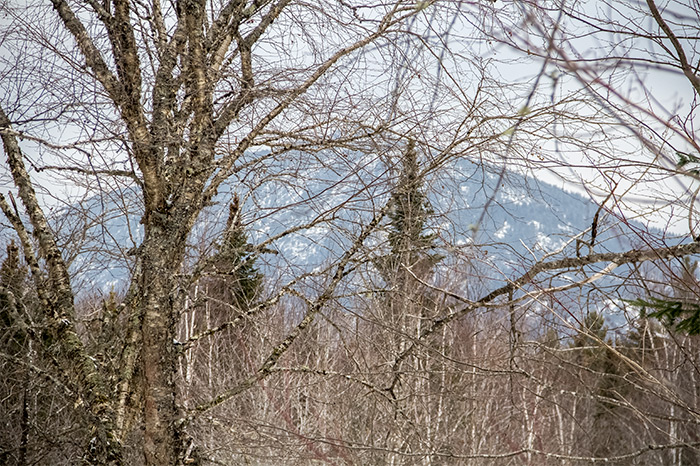
After an hour or so, we made it back to the bridge, where I grabbed a better shot of Little Bigelow Mountain. You should see this thing. It’s not visible in these photos, but this mountain is very imposing. It’s huge and right next to it is the Bigelow Mountain range.
As a little surprise for you, I took some video of us driving on the mountain road. I just uploaded it straight to Youtube, so there’s no editing or anything. I simply wanted to capture how fun it was to drive on this thing. This is a relatively flat area. If you’re on a computer, you can see this. If you’re reading this in your email account or are on a phone, you can’t. If that’s the case, click the link below.
Overall, this was a spectacular day. My favorite part was driving on the mountain road and hiking all the way to the hut, which was unexpected. We’ll be spending a lot more time up in this area because there are a few more huts and endless hiking. It’s like a giant playground for adults.
Back to the Poplar Hut Trail
February 20, 2018
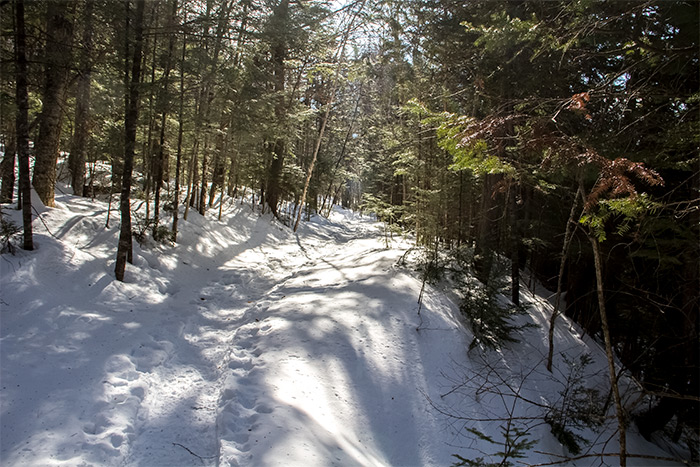
Yesterday was a great day. Laura and I went back up to the snow trails that lead to Poplar Hut in Carrabassett, Maine. We’ve had some snow over the past week and I wanted to see how the trails looked. The Maine Huts & Trails group grooms the trails for hiking and cross-country skiing, so I had every confidence that we’d enjoy ourselves immensely.
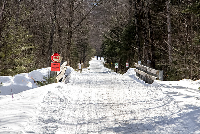
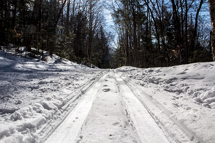
We parked in the same lot at the Carrabassett town office. Then, again, we took Carriage Road east, but this time, instead of walking or driving up Carriage Road, we decided to head into the Poplar Hut trail head parking lot. This is a photo of the trail leading to the lot.
Since we have yet to enter the trail from this end, I didn’t know what to expect. Nothing was out of the ordinary though and we saw and decided to venture on what looked like a regular old trail through the woods. There was even a map at the beginning.
After walking on the trail for a few minutes, I decided it was time for a photo shoot. This was the best one out of the bunch. It was warm outside so there was no need for any more clothing than what I was wearing.

What’s really cool about this particular trail is that it hugs the southern side of Poplar Stream. Carriage Road hugs the other side. As we were hiking the start of the trail, we could see the road just a short distance away.
For this part of the trail, the walking area was a bit narrow. We had to make sure we didn’t veer off the packed down snow too far or we’d fall in up to our knees.
The area was much more interesting than I had expected. There were tons of hemlock trees and all sorts of hills and rocks and all of that. It really is a beautiful area.
Since this was our first time on this trail, we had no idea where we were going. It only took a short time for us to figure that out. After walking on the skinny trail briefly, we were spit out onto the larger and more substantial trail. This is the one everyone uses to get up to Poplar Hut. This is where people snowshoe and ski and hike.
Here are some of the embedded cross country ski tracks.
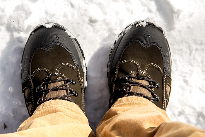
Check this out. I even got to try out my new Cabela’s Snow Runners on the trail. I didn’t have a need for my spikes though, so I was a little disappointed in that. Still, I had fun with the boots.
There were all sorts of people out yesterday enjoying the weather. Everyone was exceedingly friendly, except for one nasty crab. I’m assuming she was an out of stater who didn’t get the vibe. But whatever. Everyone else was nice. Here’s one skier and a few hikers.

There was even a kid who looked about ten years old. He was out there all alone, which I found a bit strange. But who am I am judge? He was having a great time in the sun.

There’s really nothing like hiking in the snow. It’s perfect, especially when it’s sunny outside. Everything is so bright.

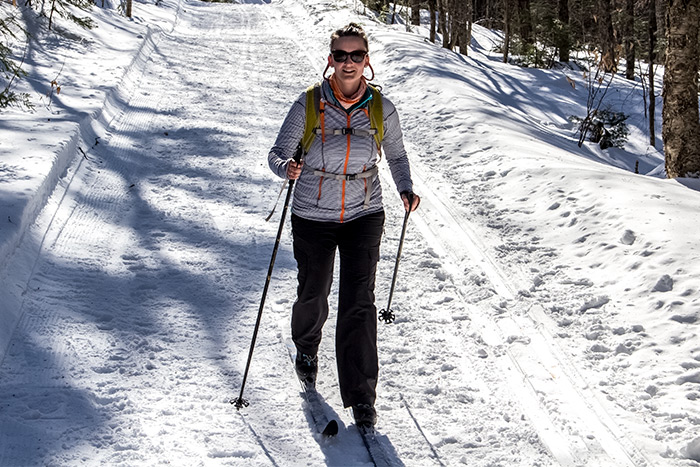
This is Jess. She’s part of the crew at Maine Huts & Trails. We met her and she was gracious enough to let us take her photo. What a sport.
There were even people towing sleds with supplies and people inside of them. Here’s one person pulling what appeared to be his daughter.
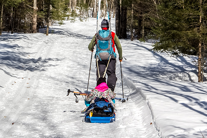
She seemed to be thrilled with the whole situation. I would be too, to be honest.
In my previous post about this area, I think I may have mentioned that there’s a bridge from Carriage Road to the Poplar Hut main trail. Well, on our way back, we were sure to walk across it. I love these little bridges. They’re all over the place and they’re perfect for photography. I just think that foot bridges in the woods, where no cars are allowed, are the coolest thing.
After crossing the bridge and heading out onto Carriage Road to begin our walk back to the car, I noticed another trail that heads up the mountain. After doing some poking around on Google Maps, I discovered that this trail leads to the Airport Trailhead. So if you didn’t want to walk the rail trail to the trailhead and if you wanted to ski it, you could by taking this route.

Finally, when we made it back to the car, we noticed the Bigelow Preserve (I believe) right in front of us. You know what that means. More pictures. Here’s the best one from this batch.
After all that, I snatched a photo of a nearby house. Doesn’t it look so peaceful? What a perfect place to retire. There are some many things to do around Carrabassett Valley that it makes my head spin.

I could deal with that house. It’s so simple and easy to live in.
Anyway, thanks for reading about this latest adventure. I’ll write more as it happens. Have a great day!
Hiking Around Carrabassett with my Wide Angle Lens
January 7, 2019
I really had only one goal in mind. That was to get out there to see what my wide angle lens could do. I’ve had this lens for quite a while, but haven’t used it in some time. I’ve been so busy with the Canon 18-135mm that I recently purchased that I sort of put the Sigma wide angle in the back seat. Well, last night, I got a great idea. We’d head up to Kingfield and Carrabassett to hike around in the snow for a while to see if there was anything worth taking photos of. We’ve been to the area so many times that it’s getting worn out somewhat when I want to discuss it on this blog. Today I though that I’d focus on the type of lens I was using as opposed to the hike itself. But I’ll talk about the hike too. Albeit briefly. I’ll mostly just complain about how cold I was.
Have you ever hiked in 17 degree weather? I know that doesn’t sound bad, but how about 17 degree weather when it was windy? I have no idea what possessed me when I came up with the idea to go into the woods in this weather, but we made the best of it. After getting out of the car, my ears nearly froze off and by the time we made it about a quarter of a mile down the road, towards the bridge that leads into the trail, my forehead was numb and my left nostril felt like it would crack right off. After we got onto the trail though, things warmed up a bit. The trees shielded us from the wind and I decided to put on my hat and gloves. Before that, I thought I could brave the cold for a while and take photos with no gloves on. Doing that made my fingertips very chilly. They actually hurt. As I was trying to warm them up by breathing on them, I thought about running them under hot water like I used to do when I was a kid. Boy, what I did back then was stupid. Have you ever run your fingers under hot water when they’re freezing cold? Not a good move. The pain!
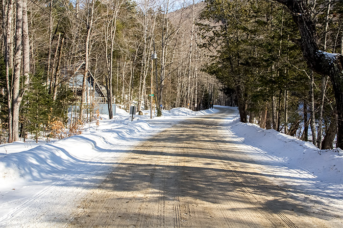
I did manage to snap a few photos though. The first one is of the famous Carriage Road that closes each spring because the town tries to keep the road in as good condition as they can. It’s dirt and if driven on at the wrong time of year, it will turn into mud pronto. So, for a few months, they close things down so no one can drive through from one end to the other. As a matter of fact, this is the very same road we drove on to the waterfall last winter.
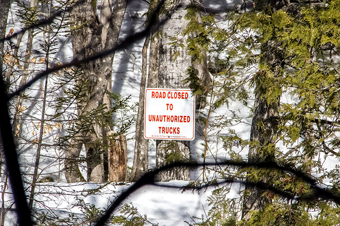
I mention that we drove on this road for good reason. Since we did, I’ve been warned about doing that because throughout the day, huge logging trucks use this route to transport their logs from where they cut them to where they drop them off, wherever that may be. If you’ve never seen a logging truck, let me tell you that they’re pretty huge. The last time we were on this road, I didn’t give oncoming traffic much consideration. This time, since being warned, I did. As we walked on it, I noticed how thin it truly is. There’s no way we’d be able to pull over if confronted by a logging truck. If that happened, I’d probably have to punch it to go right through. Know what I’m saying here? Nobody plays chicken with this guy.
Check out the road. Pretty, but narrow.

Oh yeah, it’s also fairly close to being a sheet of ice. I love that fact about it.
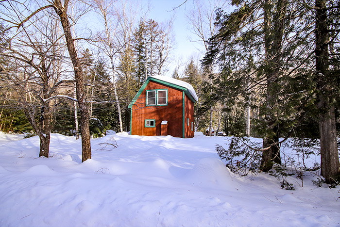
Along the route to the bridge is a small cabin type house that we’ve never actually seen anyone inside of. It’s in a great area, right on the river, and I would think that at least someone would want to enjoy that. I’m sure we’ll see some activity someday.
Are you noticing my wide angle lens at work? No? you will towards the end. I’ve got some groovy photos down there. You just wait.
This is the bridge I’m referring to. I would never have been able to capture all this scenery with my regular lens. That one maxes out at 18mm and this one maxes out at 10mm. Needless to say, this one is a lot wider.
Right past the bridge, along the trail to the Poplar hut, is Poplar Stream. I fell in snow that was (unexpectedly) up to my knee to get this shot. That’s the bridge in the distance.
It was so cold that I wanted to walk for just a few minutes and then return to the car to warm up, but I was persuaded to continue on and hike through the trail we were supposed to hike through. I didn’t put up much of a fight because I’m a very easygoing kind of chap.
To make a long story short, we hiked and then went back to the car. We drove into Kingfield and visited with some friends in the Herbert Grand Hotel. That’s always fun. Then, after that, we went across the street into Annie’s and got ourselves some good ol’ Carrabassett Coffee. That’s the good stuff.
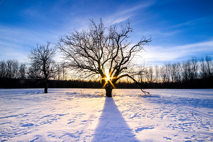
On the way back home, we passed by a field that looked rather stunning. The sun was hanging in the sky just the right way to make it filter through one of the apples trees we’ve been admiring since we arrived in the area. This field is only a few miles from where we live, so we see these trees often. Anyway, because I know a photo op when I see one, I pulled over and parked the car. We got out, jumped the snow bank and walked our way towards one of the trees.
When we got close enough, we started snapping away. I must have taken 30 shots. I tried a few different variations of settings, but I found that a small aperture setting of f/22 worked wonders for giving me the starburst I was after. This is a shot as I was approaching the tree. I tried to have the sun sit directly behind it.
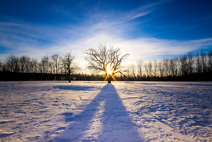
This is another shot as I got closer to the tree. Trust me, I’d love to post all 30 photos, but I’m sure you’d get bored of looking at them after a while.
I might just have to print one of these shots out to hang on the wall. I like them a lot.
On the way back to the car, I asked if I could kindly have my photo taken. I received a new coat for Christmas and I’ve been bragging about it ever since. I’ve received a lot of “lumberjack” comments about it, so I guess that’s what people are making of it. By the way, this one comes from our friends at Cabela’s. It’s nice and toasty warm, yet I still can’t figure out how to look natural in a photograph. By the way, I hope you like how buff I look in the jacket. I had it stuffed with not only my body, but a few shirts and a thick wool sweater.
Finally, because I just couldn’t leave well enough alone, I took a few more shots. This time though, I wanted to focus on our path in the snow to the tree.

I really do love my Sigma 10-20mm wide angle lens. I think I’ll keep it on my camera for a while. It’s more artistic than my primary lens.
Well, there you have it. Another trip up north for some walking around in the woods, plus other things. I hope you enjoyed!
Photographing the Carrabassett River & Bigelow Preserve
August 2, 2019
A few weeks ago, Laura and I had the itch to get out there and photograph a few different areas of the beautiful state of Maine. We initially had planned on going to the Rangeley area because it’s got lots of peaks, valleys, lakes and streams. It’s always a good time in Rangeley. For some reason though, on our way up north, I suggested that we visit Carrabassett Valley and Eustis instead. I can’t even remember the reason, but I think it was a good decision. We hit a home run with some of the spots we chose to photograph.
On our way up Rt.27 in Carrabassett Valley, I pulled the car over in a scenic rest area. These rest areas up here are very quiet and they’ve got picnic areas in them. I think they’re primarily for the Canadians to use as they’re passing through. If I’m not mistaken, there are two different rest areas on Rt.27 north of Kingfield and both are very nice. Both also hug the Carrabassett River.
As we were exploring the grounds, I made my way over to the end of the parking area, where I noticed a small trail that led down to the river. We both walked down the trail and saw what was at its end. We then agreed that we should head back to the car to get all our gear. We brought a few different lenses with us as well as our tripod and things like that. Check out this scene.
I captured this with my Canon T7i. I also edited it using Adobe Camera Raw.
The one thing I forgot was my lens filters. Actually, since I was using my new Canon 24mm f/2.8 lens, I didn’t own any filters I could use. That has since been remedied, but if I had brought filters along, I would have chosen to take some long exposure shots to smooth out the water. You simply can’t get away with long exposure shots in the bright sun like this without filters.
Our next stop (and ultimate destination) was in the parking lot of a small gas station up in Eustis, which is just north of Stratton, Maine. This is an absolutely stunning area and if there is one place I’d like to retire to, it’s the Stratton area. Big mountains and beautiful lakes. You can’t ask for anything more.
We’ve been to this area before, but we’ve never been as ready to snap some photos like we were during this trip. We walked down a flight of stairs to a small dock and set up shop. This is what we saw across Flagstaff Lake. It’s the Bigelow Preserve.

Our final stop was at another rest area along Rt.27, just south of Eustis and north of Stratton. From this vantage point, we were able to see the end of the Bigelow mountain range, which looks much less imposing than the range does in the previous shot. It’s really a great view though and, you can’t see it, but Flagstaff Lake is just past the high grass and before the mountains. Take a look.

Overall, I’d say we had a great day of photography. We do much better when we bring all our gear and head out with taking photos in mind. We take it more seriously and I think our shots show it. Thanks for reading!
There is no shortage of trails on which to ride ATVs in Maine and the Carrabassett Valley and Bigelow Preserve areas are an excellent example of a just about perfect system. Laura and I have been visiting these areas for years in our car. During these visits, we’d see trail maps sitting on the counters of local gas stations. After buying my Polaris Sportsman ATV, it didn’t take long for us to make a first trip for some riding. In the two posts that follow, you’ll find a variety of photos and trail information regarding all terrain vehicle recreation in this part of Maine. For more information, be sure to contact the local club for the area you’re interested in.
Where to Park When ATV Riding in Carrabassett Valley, Maine
September 10, 2019
This fall, we’re going to be doing some ATV riding up in Carrabassett Valley, Maine. As you may already know, we’ve done a lot of hiking up in that area and personally, I find it lovely. There aren’t many people in Carrabassett, yet they have one of the best trail systems around. And that’s just for people who plan on using only their feet. When it comes to riding ATVs, the trails are just as good.
Western and northern Maine offer extensive ATV trail systems. I think many of them are built upon old logging roads, but a good percentage have been created and maintained by local town ATV clubs. I keep meaning to join one of these things to show my support (financial and moral), but I haven’t gotten around to it yet. The cost is only about $30 per year and the money goes towards equipment, fuel and a lot of other things that help keep the trails clear and in good condition. I recently read on one of the club’s Facebook pages that eight new bridges were built over this past summer. Yeah, I’d say that’s kind of important. Especially for people like me who don’t like to get their ATVs dirty. I know, I know. It’s just that it’s so nice and clean right now and I don’t want to ruin that. It’s a beautiful machine.
Okay, to the point of this post. Since I’ve never ridden up in Carrabassett Valley before, I had no idea where to park my truck. When I lived back in New York and wanted to go riding, we’d have to sneak to some dirt road somewhere and unload there. Of course, blowing your nose is illegal in New York, so we had to be very careful when it came to where we rode and who saw us. In Maine, things are quite different. Each town encourages their ATV clubs and one town that I know of actually created their club themselves. It’s legal to ride on the roads in some areas and from what I’m told by the Game Wardens, you don’t even need to have your ATV insured. I find that strange, but who am I to argue?
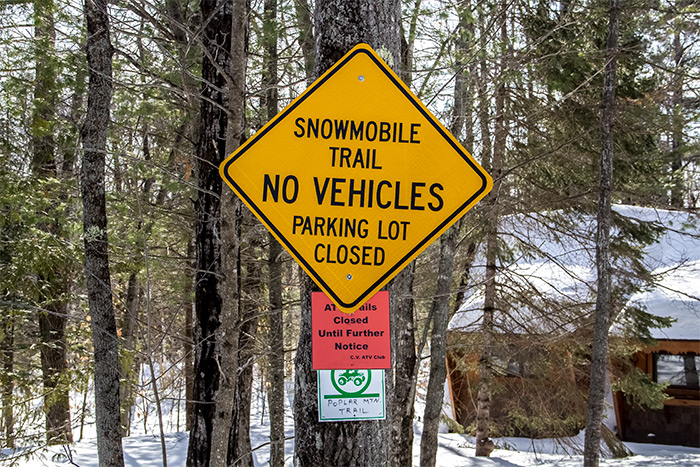
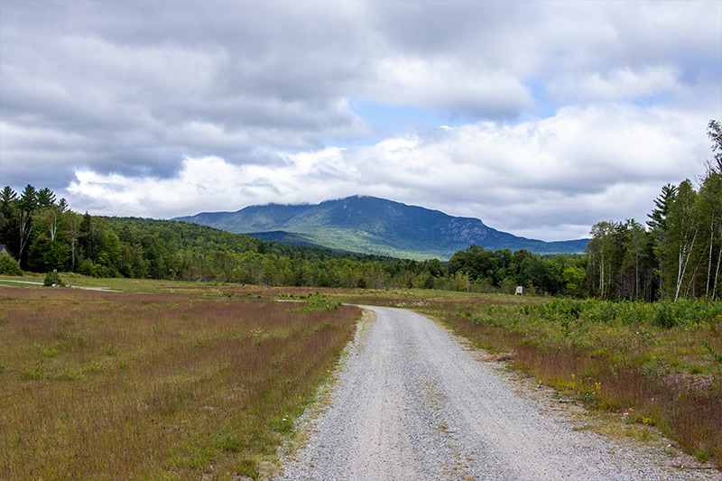
There’s an airport in Carrabassett Valley. It’s called the Sugarloaf Regional Airport and it’s located just south of Sugarloaf Mountain. Directly north of the airport is a parking lot. It’s accessed by Rt.27.
This parking lot is used by hikers who want to walk along the rail trail, ATV riders who want to ride on the trails in the area as well as snowmobile riders who want to also ride on the local trails. It’s a fairly large lot, so I don’t think there is any problem with overcrowding. Although, I’ve never been there during the height of the season, whenever that is. A snowmobile club is actually right next door, as is the SugarBowl bowling alley. They serve food, which can be handy.
Laura and I drove up to this parking lot last week to check it out. We found it perfect for our needs. We also went up to the area to purchase a trail map, which we were lucky to get. These maps are sold in Ayotte’s Country Store and apparently they’re very rare. For $1, I bought the last one. Here it is.
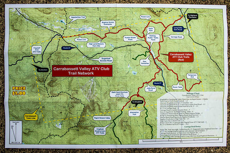
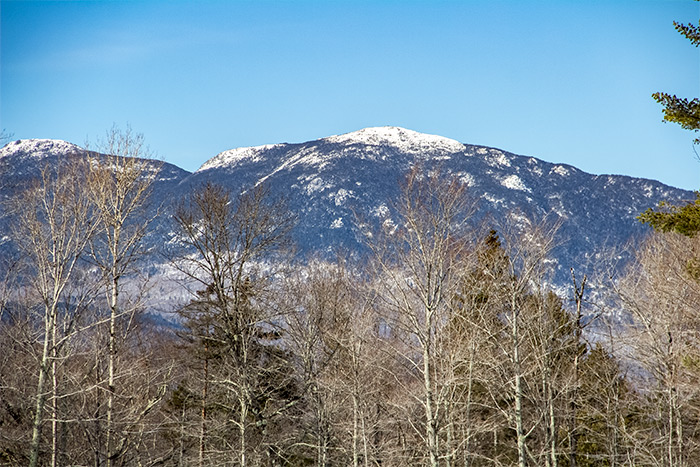
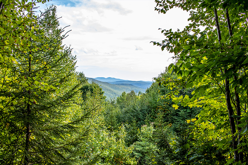
All the trails from one area connect to the trails of another, so it’s a good idea to get the maps of a few different systems. In Carrabassett Valley, I’m most excited about climbing a few mountains to see some views of the Bigelow Preserve. From what the map says, there are some different lookout points. We’re just waiting for the leaves to start changing color to get out there.
Here’s a photo of the Bigelow Preserve, from the south.
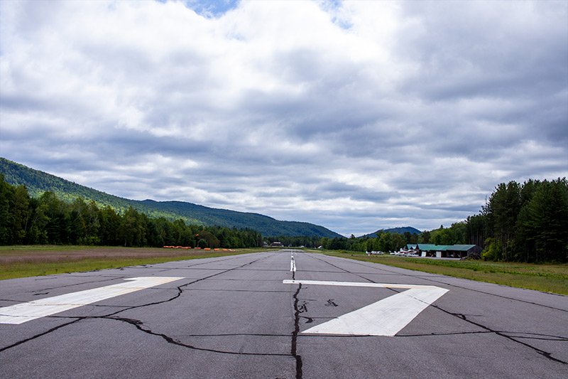
While we were up there, we walked snapped a few photos of the airport runway and the surrounding landscape. This is a photo of the runway.
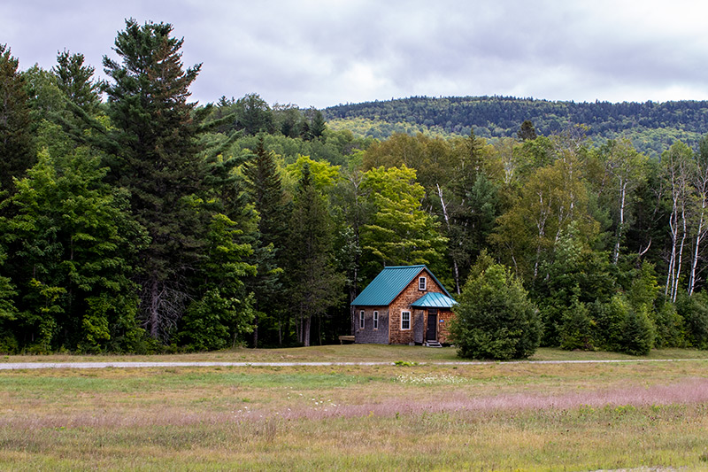
This is a shot of a small cabin that’s situated on the airport property. I’m not sure if someone lives in it or not.
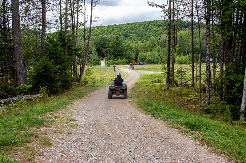
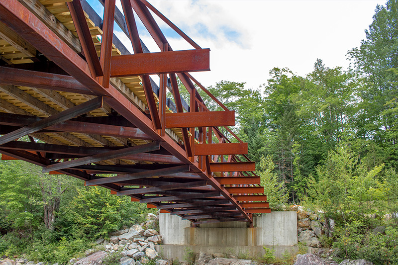
Since we were in the area, we thought we should also take a stroll over to the Carrabassett River to see the bridge they put up. We’ve seen it before, but it’s always nice to check it out if we’re nearby. This time, we were lucky enough to have a few ATVs pass us by.

Finally, I took these shots from under the bridge because I thought they were from some neat angles. I like them.

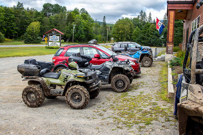
Last but not least, here are a few photos of riders (or their machines) who stopped to eat some lunch at the SugarBowl bowling alley. See what I’m saying? You can drive ATVs in this area like cars. Well, almost.
ATV Riding Around the Bigelow Preserve in Maine
September 19, 2019
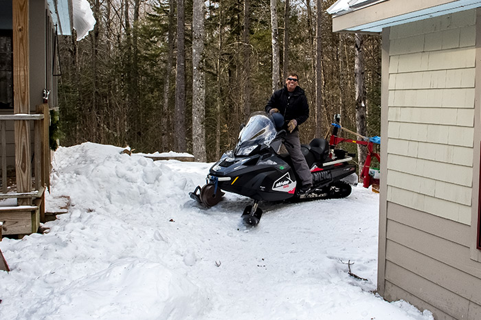
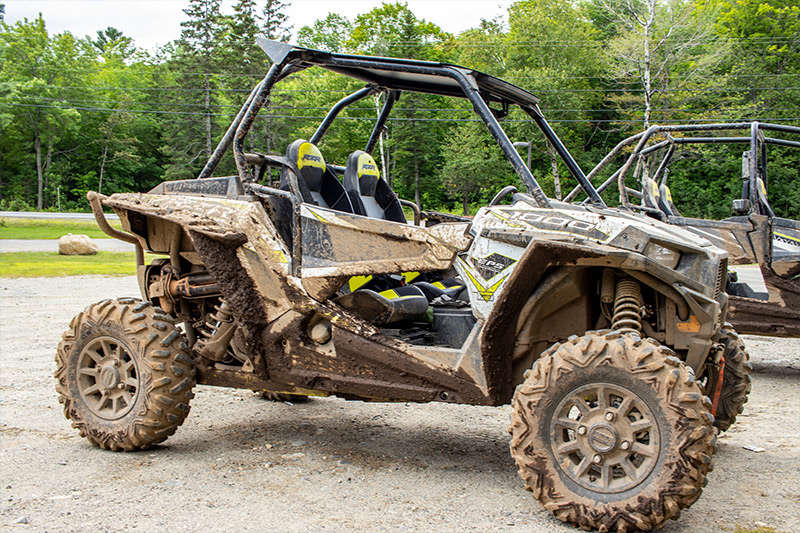
We took the quad out for its true maiden voyage this past Sunday. While we’ve ridden locally and in the back woods a few times, those rides weren’t anything compared to what we just experienced. If memory serves, I bought the ATV with 600 miles. The first few rides added about 15 miles and now it’s got 650 miles on it. That means that we rode 35 miles on Sunday. I don’t know…in my book, that’s kind of a lot. It’s probably not a lot to people around these parts, but for me, it’s a lot.
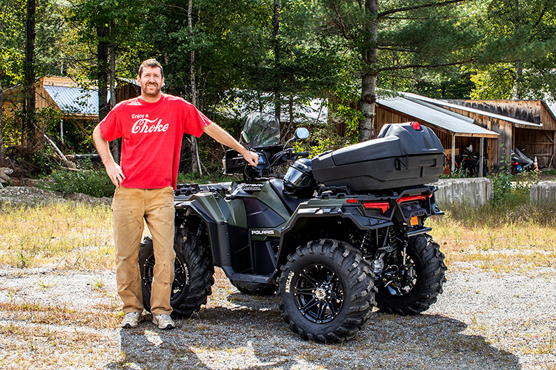
I get excited at times like these. So excited, in fact, that I completely forget to take the photos I intended to take during the trip. Luckily, I took a breath to relax and snapped a few of the ATV and the truck right after I unloaded things.

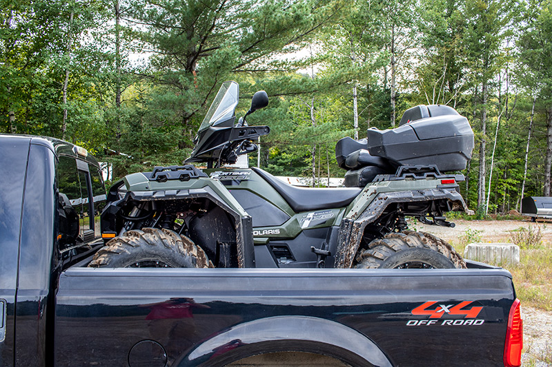
We parked up at the top of the Sugarloaf Regional Airport I described in one of my previous posts. It’s a great spot with lots of room and not too many people to watch as I clumsily set up the ramps and drive this very heavy machine down them backwards. I was slightly nervous about that, but I did fine – both driving backwards and then forwards at the end of the day when I had to load it back up.
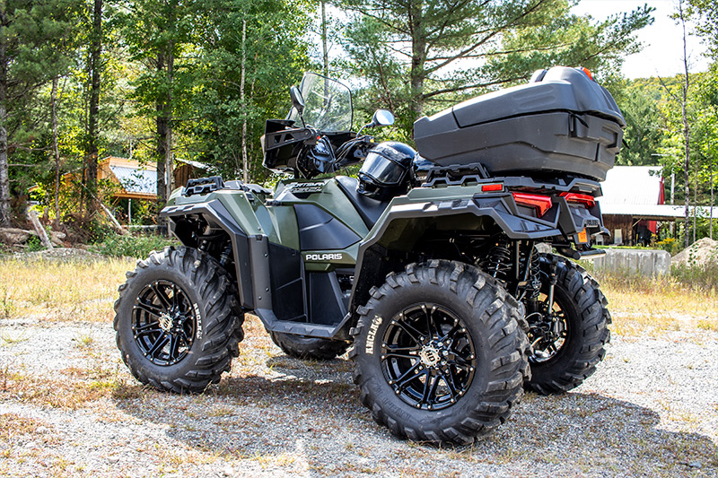
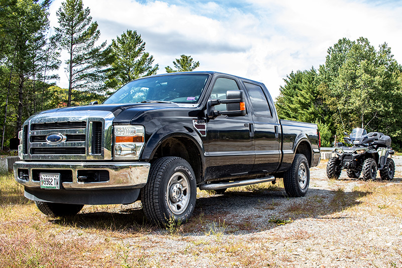
The ATV fits perfectly in the back of the truck with not an inch to spare. I can even close the tailgate, which is nice. That saves me all the time I would have spent tying it down. Also, I have two sets of ramps. One set that I bought a while back to load things into my trailer and another set that the guy I bought the ATV from gave to me. His set was more heavy duty, so that’s what I use when I load this 850 pound beast. Boy, these new ATVs sure are a far cry from the ones we used to ride back in the 80s. Those were a few hundred pounds. These are 4-wheel drive, have electric fans, dashboards and just about every other amenity you can imagine. No wonder they’re so damn expensive.
This is what it looks like when the Polaris Sportsman 850 is loaded on my Ford F250. Like I said, it’s a tight fit. We took these photos at the end of the day. I would never keep the ATV this dirty.
I used to position wooden blocks to stop the front tires from meeting the front of the pickup bed. I was concerned about the quad’s front bumper hitting and breaking the rear window of the truck. I noticed that the bumper doesn’t even come close to the window naturally, so I removed the blocks and that’s what allowed me to inch the machine forward and to close the tailgate.
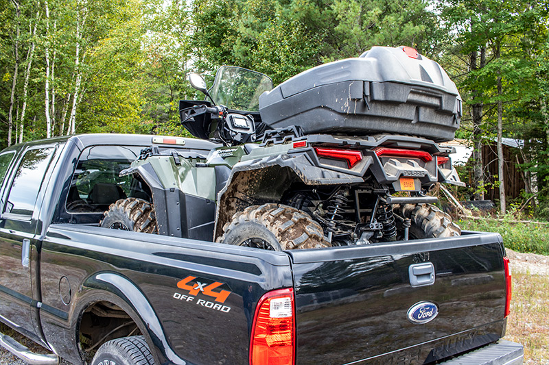
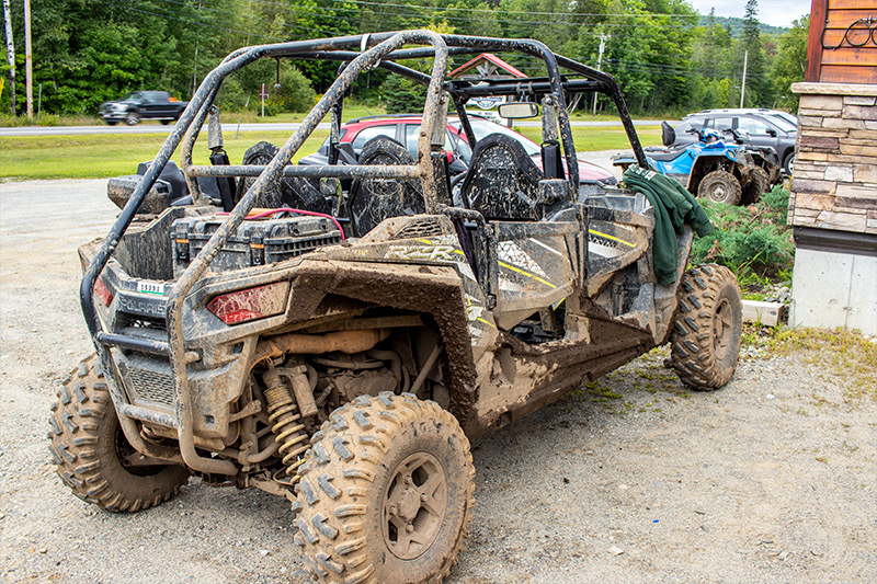
By the way, that big box thing on the back is a seat for a passenger as well as a trunk. This is an extremely helpful feature. We’ve used the trunk to our delight. It’s great for camera tripods, backpacks and the like.
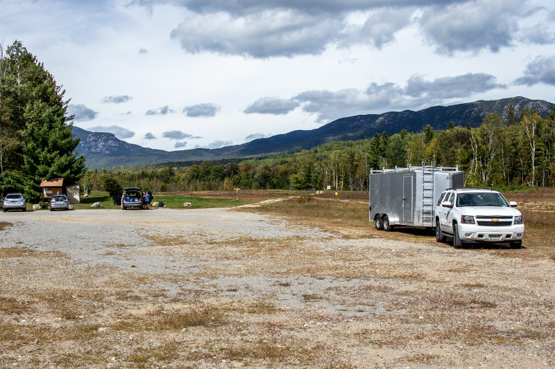
Here’s a photo of the parking lot. That mountain range in the background is the Bigelow Preserve. It’s an awesome place for hiking and camping and all that. The Appalachian Trail travels right along the entire peak.
Our original goal was to ride on some trails that were situated on the western side of the mountain range. I picked up a trail map of the region and figured we’d see some nice views of the preserve as well as get some mileage under our belts. We did this and at the beginning, things were wonderful. The trail was more like a smooth dirt road and I liked riding on it a lot, especially because I had a passenger. I was excited to make it to the spot designated as a scenic view of the Bigelow Preserve.
Unfortunately, we encountered some signage that indicated that folks like us who were riding ATVs weren’t welcome on the smooth road any longer and were instructed to shuffle off onto a path that was fairly rocky and not nearly as nice as the road. We turned onto that and made it only about a half mile before I lost interest and turned around and headed back for the airport. I knew of other trails I wanted to explore. We never made it to the lookout point.
After making it back to the truck, we crossed Rt.27 and rode on a trail that ran south and parallel to that until we made it to Carriage Road. This road is the same one I wrote about driving on during the winter. It cuts right through, from Rt.27 to Long Falls Dam Road in the Flagstaff Lake region. It’s a super shortcut and I’m just amazed that we’re allowed to ride on it legally. It’s almost all legal up here and it truly is a great state in which to own an ATV.
At the end of Carriage Road, we made a left onto East Flagstaff Road. We have some friends who were camping up on Bigelow and they parked their car down in one of the parking lots at the base. I wanted to see if we could find their car. We ultimately did and then decided to park the ATV and walk around for a while. The Appalachian Trail cuts right through, so I wanted to walk about ten feet on it, just to say I did.
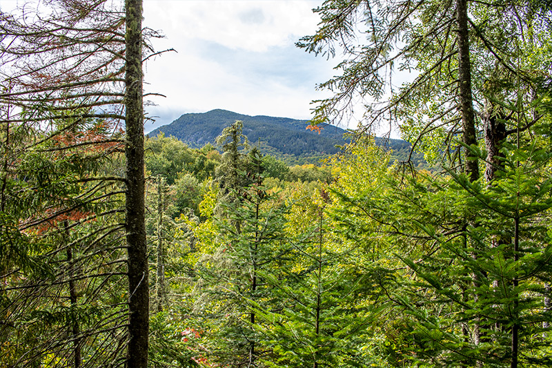
Here are a few photos of the area. This is the southernmost mountain in the Bigelow Preserve. I took this after climbing a portion of the AT.
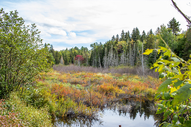
This is a swampy area that was right next to the road.
It’s a beautiful area up there and we enjoyed ourselves. Oh yeah, this is what the Sportsman looks like when it’s parked on the side of a dirt road. I took this photo right after I took the one of the swamp. I can’t get enough of this thing. It’s such a rugged looking beast! It’s like looking in the mirror.

After hanging around for a while, we decided to head back to the truck. We traveled on Carriage Road again and when we got to the bottom, back near the airport, I noticed a sign that claimed there was a scenic view about 2.9 miles up a mountain trail. I didn’t necessarily want to ride the entire 2.9 miles, but once we were on the trail, we just ended up going the entire way. I’ll admit, it was kind of a long ride and the terrain was tough at times, but we made it to the scenic view. I think it was worth the ride.
It’s such a nice area up there. I like the way that we were totally alone. We were deep in the woods, which was so cool. Granted, it was kind of freaky because I wonder what I would do if the ATV didn’t start for some reason, but it did and we made it back fine. Not before I had a photo taken of me getting back on the quad though.

Overall, I’d say we had a good time. The weather was perfect and the ride was fun. I’m looking forward to exploring the rest of the state of Maine on this ATV. Lord knows there’s no shortage of trails. Thanks for reading!
Leave a Reply